

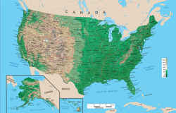
Geographic Regions of the US
Regions of the United States are Geographic Areas
Region is a geographical term that is used in various ways among the different branches of geography. A region can be defined by physical characteristics, human characteristics and functional characteristics. In other words, a region is an area of land that has common features. A region can be defined by natural or artificial features. Language, government, or religion can define a region, as can forests, wildlife, or climate.
In general, a region is a medium-scale area of Earth or water, smaller than the whole areas of interest (which could be, for example, the world, a nation, a river basin, mountain range, and so on), and larger than a specific site or location. A region can be seen as a collection of smaller units (as in "the New England states") or as one part of a larger whole (as in "the New England region of the United States").
The regional groupings presented here and their definitions are from standard language used by libraries and reflect the groupings used in the classification system for maps.
Geographic Regions of the US |
|
|---|---|
Regions |
Definition of Geographic Region |
| Appalachia | The Appalachian Region, as defined that follows the spine of the Appalachian Mountains from southern New York to northern Mississippi. It includes all of West Virginia and parts of 12 other states: Alabama, Georgia, Kentucky, Maryland, Mississippi, New York, North Carolina, Ohio, Pennsylvania, South Carolina, Tennessee, and Virginia. |
| Atlantic States | All states Maine to Florida that are near to or border on Atlantic Ocean |
| East | All states east of the Mississippi River |
| Great Plains | Great Plains include parts of North Dakota, South Dakota, Montana, Wyoming, Colorado, Nebraska, Kansas, Oklahoma, New Mexico, and Texas. |
| Middle Atlantic States | Delaware, District of Columbia, Maryland, New Jersey, New York, Pennsylvania |
| MidWest | Rocky Mountains to Allegheny Mountains, North of Ohio River and southern border of Missouri and Kansas: Illinois, Iowa, Indiana, Kansas, Michigan, Minnesota, Missouri, Nebraska, North Dakota, Ohio, South Dakota, Wisconsin |
| New England | Connecticut, Maine, Massachusetts, New Hampshire, Rhode Island, Vermont |
| Northeastern States | East of Mississippi River, North of Ohio and Potomac Rivers: Connecticut, Delaware, District of Columbia, Illinois, Indiana, Maine, Maryland, Massachusetts, Michigan, New Hampshire, New Jersey, New York, Ohio, Pennsylvania, Rhode Island, Vermont, Wisconsin |
| Northwestern States | Northern part of US between western edge of Lake Superior and Pacific Ocean: Idaho, Iowa, Kansas, Minnesota, Missouri, Montana, Nebraska, North Dakota, Oregon, South Dakota, Washington, Wyoming |
| Northwest, Pacific | Old Oregon country: Idaho, Oregon, Montana, Washington, Wyoming |
| Pacific States | Alaska, California, Hawaii, Oregon, Washington |
| Rocky Mountain | Arizona, Colorado, Idaho, Montana, Nevada, New Mexico, Utah, Wyoming |
| South Atlantic States | Florida, Georgia, North Carolina, South Carolina, Virginia |
| Southern States | South of Mason-Dixon Line and Ohio River, from western Texas border to the Atlantic Ocean: Alabama, Arkansas, Florida, Georgia, Kentucky, Louisiana, Mississippi, North Carolina, Oklahoma, South Carolina, Tennessee, Texas, Virginia, West Virginia |
| Southwestern New | Corresponds to old Spanish province of New Mexico including Arizona, California, Colorado, Nevada, New Mexico, and Utah |
| Southwest, Old | Southwestern US before cessions of land from Mexico following Mexican War: Arkansas, Kentucky, Louisiana, Missouri, Tennessee, Texas |
| Southwestern States | Southern US West of Mississippi River: Arkansas, Arizona, California, Colorado, Louisiana, Nevada, New Mexico, Oklahoma, Texas, Utah |
| West | All states west of the Mississippi River |

