


New York State Almanac: Facts and Figures
Quick Facts, Figures, and Overview of the State of New York
New York is one of the Middle Atlantic states of the US. New York is bordered by New Jersey and Pennsylvania to the south and by Connecticut, Massachusetts, and Vermont to the east. The state has a maritime border with Rhode Island east of Long Island, as well as an international border with the Canadian provinces of Ontario to the west and north, and Quebec to the north. New York was named by the British to honor the the Duke of York and Albany, the brother of England's King Charles II, when New Amsterdam was taken from the Dutch in 1664.
New York has long been a leader in the political, cultural, and economic life of the US Despite economic difficulties in the 1970s and '80s, mainly in New York City and other urban areas, the state still ranks among the US leaders in such important sectors as manufacturing, commerce, foreign trade, communications, and finance. The great metropolis of New York City is the nerve center of the nation. It is a leader in manufacturing, foreign trade, commerce and banking, book and magazine publishing, and theatrical production. A leading seaport, its John F. Kennedy International Airport is one of the busiest airports in the world. New York is also home to the New York Stock Exchange, the largest in the world. The printing and publishing industry is the city's largest manufacturing employer, with the apparel industry second. New York farms produce cattle and calves, corn and poultry, and vegetables and fruits. The state is a leading wine producer.
New York Almanac: Facts on the State of New York |
|||
|---|---|---|---|
| Official Name | New York | ||
| Capital | Albany | ||
| Nicknames | Empire State ...and more | ||
| Motto | Exelsior (Ever upward) | ||
| Location Region |
42.66575 N, 073.79901 W Middle Atlantic Northeastern Appalachia |
||
| Constitution Ratified | 1777 | ||
| Statehood | July 26, 1788 11th state |
||
| Population | 19,254,630 (2010) 401.84 sq. mi. 3rd |
||
| Largest City (by population) |
10 largest cities (2005 est.):New York, 8,143,197; Buffalo, 279,745; Rochester, 211,091; Yonkers, 196,425; Syracuse, 141,683; Albany, 93,523; New Rochelle, 72,967; Mount Vernon, 67,924; Schenectady, 61,280; Utica, 59,336 | ||
| Bordering States | North: Canadian provinces of Ontario and Quebec East: Vermont, Massachusetts, and Connecticut South East: Atlantic Ocean South: New Jersey and Pennsylvania West: Pennsylvania and Ontario (Several boundaries are formed by bodies of water, including Lake Ontario and the Saint Lawrence River, in the North; Lake Champlain and the Poultney River, in the North East; the Hudson and Delaware rivers, in the South East; and Lake Erie and the Niagara River, in the West) Coastline: 127 mi. |
||
| Major Industry | finance, communications, international trade, publishing, fashion, communications, farming (fruit and dairy), tourism | ||
| Major Rivers | Hudson River, Mohawk River, Genesee River | ||
| New York Counties | 58 Counties in New York | ||
| Largest County (by population) |
Kings County | 2,486,235 (2005) | 309 sq. mi. |
| Brooklyn has had the same boundaries as Kings County, which is the most populous county in New York and the second-most densely populated county in the United States, after New York County | |||
| Largest County (by area) |
St. Lawrence County 2,686 sq. mi. |
||
| State forest preserves | Adirondacks, 2,500,000 ac.; Catskills, 250,000 ac. | ||
| State parks | 176 | ||
| Largest County (by area) |
St. Lawrence County | ||
| Presidential Birthplaces |
Martin Van Buren was born in Kinderhook on December 5, 1782 (he was the 8th US President, serving from 1837 to 1841). Millard Fillmore was born in Locke Township (now Summerhill) on January 7, 1800 (he was the 13th US President, serving from 1850 to 1853). Theodore Roosevelt was born in New York City on October 27, 1858 (he was the 26th US President, serving from 1901 to 1909). Franklin Delano Roosevelt was born in Hyde Park on January 30, 1882 (he was the 32th US President, serving from 1933 to 1945). |
||
| Electoral Votes | 31 (as of the 2004 Presidential Election) | ||
| US Congress | 2 Senators; 29 Representatives | ||
| Time Zone | Eastern Standard Time | ||
| Zip Codes | NANPA | ||
| State Quick Facts | Census Bureau Quick Facts | ||
New York Climate and Weather |
|
|---|---|
| The summer are pleasantly warm-to-hot temperatures in the Catskill, Adirondack or Finger Lakes areas of
New York. Temperatures in the upper 70's F/25 C to mid 80s F/29 C are common in all
but the higher elevations. Nights are cool in the interior Upstate: Lows can dip to 40 F/4 C, so take along something warm.
Fall has New York City loosing its high temperatures and stifling humidity. Comfortable temperatures of 60-72 F/15-22 C predominate. Winter snowfall can be very heavy in the snow belt along Lakes Erie and Ontario (one Location Spring near Lake Ontario and Lake Erie can be cool and cloudy, but average state temperatures are in the 30s-60s F/1-20 C in April and May. |
|
| Highest Temperature | 108 degrees July 22, 1926 - Troy |
| Lowest Temperature | -52 degrees February 18, 1979 - Old Forge |
| Avg. Temp: High - Low |
85.3 degrees - 11.9 degrees |
New York Points of Interest |
|
| New York State offers a plethora of things to see and do, including the Adirondacks and Catskill Mountains, the pristine Finger Lakes region, the Hudson River Valley, Niagara Falls, Long Island beaches and resorts, the Thousand Islands (St. Lawrence River/Seaway region), historical Saratoga, and of course, New York City. | |
New York Highest, Lowest, and Mean Elevations (Feet) |
|
| Mean Elevation: 1,000 feet | |
|
Highest Point: Mt. Marcy: 5,344 feet
|
|
| Lowest Point: | Atlantic Ocean Sea level |
New York Land Area (Square Miles) |
|
| Geographic Center | In Madison County, 12 mi. S of Oneida and 26 mi. SW of Utica Longitude: 76°1.0'W Latitude: 42°57.9'N |
| Total Area | 54,556.00 sq. mi 27th |
| Land Area | 47,213.79 sq. mi 86.55% |
| Water Area | 7,342.22 sq. mi 13.45% |
| Forested Land Area | 61.5% |
| Dimensions (Length - Width) |
330 miles - 283 miles |
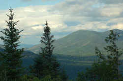 The highest point in New York, situated
in New York's Adirondack Park, a rugged 335,000-acre High Peaks Wilderness, the largest wild area in the East.
The highest point in New York, situated
in New York's Adirondack Park, a rugged 335,000-acre High Peaks Wilderness, the largest wild area in the East.Albany, Allegany, Broome, Cattaraugus, Cayuga, Chautauqua, Chemung, Chenango, Clinton, Columbia, Cortland, Delaware, Dutchess, Erie, Essex, Franklin, Fulton, Genesee, Greene, Hamilton, Herkimer, Jefferson, Lewis, Livingston, Madison, Monroe, Montgomery, Nassau, New York City, Niagara, Oneida, Onondaga, Ontario, Orange, Orleans, Oswego, Otsego, Putnam, Rensselaer, Rockland, Saratoga, Schenectady, Schoharie, Schuyler, Seneca, St. Lawrence, Steuben, Suffolk, Sullivan, Tioga, Tompkins, Ulster, Warren, Washington, Wayne, Westchester, Wyoming, Yates

