


Washington, DC State Almanac: Facts and Figures
Quick Facts, Figures, and Overview of the District

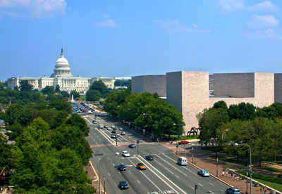
Washington, DC, city and district, capital of the United States of America, at the confluence of the Potomac and Anacostia rivers. he District is bordered by Montgomery County, Maryland, to the northwest; Prince George's County, Maryland, to the east; and Arlington and Alexandria, Virginia, to the south and west. DC, named District of Columbia, because it was built on land of the Territory of Columbia
The city of Washington is coextensive with the District of Columbia (DC) the federal district of the US. Established in 1800 as the seat of national government, a role that continues to dominate its existence, Washington is today the core of one of the largest metropolitan areas in the country and a center of both national and international politics and diplomacy.
District of Columbia Almanac: Facts and Figures |
||
|---|---|---|
| Capital Official Name | District of Columbia (Washington) | |
| Location Region |
38.90000N, 77.05000W Middle Atlantic Northeastern |
|
| Motto | "Justitia Omnibus" | |
| Municipal Corporation | February 21, 1871 | |
| Population | 632,323 (2012) | |
| Largest City (by population) |
Washington | |
| Bordering States | North, East, and South East: Maryland South West: Virginia |
|
| Number of Counties | NA | |
| Largest County (by population) |
Washington | |
| Major Industry | government | |
| Major Rivers | Potomac River, Anacostia River | |
| Time Zone | Eastern Standard Time | |
| Zip Codes | NANPA | |
| State Quick Facts | Census Bureau Quick Facts | |
DC Climate and Weather |
||
|---|---|---|
| Washington, DC experiences the four seasons of the northern hemisphere; Spring, Summer, Fall and Winter. The weather is generally mild. Spring, early summer and fall are the most comfortable seasons, with high temperatures in the low 80s, and lows in the 60s. Late summer tends to be hot and humid. Winters can be moderate, but cold conditions with significant snow is not uncommon. | ||
| Highest Temperature | ||
| Lowest Temperature | ||
| Avg. Temp: High - Low |
||
DC Points of Interest |
||
| All Washington, D.C. memorials, National Gallery of Art, Pentagon, Smithsonian Museum, US Capital Building, White House and more. | ||
DC Highest, Lowest, and Mean Elevations (Feet) |
||
| Mean Elevation: 150 feet | ||
|
Highest Point: Tenleytown, at Reno Reservoir: 410 feet |
||
| Lowest Point: Potomac River: 1 foot | ||
DC Land Area (Square Miles) |
||
| Geographic Center | Near 4th and L Streets, NW | |
| Total Area | 68.34 sq. mi. | |
| Land Area | 61.4 sq. mi. | |
| Water Area | 6.94 sq. mi. 8.82% |
|
| Dimensions (Length - Width) |
||

