


Click Image to Enlarge
Alabama Counties
Alabama currently has sixty-seven counties. The oldest county, Washington, was created on June 4, 1800, when what is now Alabama was then part of the Mississippi Territory. The newest county is Houston, created on February 9, 1903.Calhoun County, Alabama History
Calhoun County Education, Geography, and History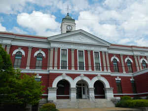
Calhoun County is a county in the state of Alabama. Based on the 2010 census, the
population was 118,572. The county
seat is Anniston. Calhoun County was created on
December 18,1832 from ceded Creek Indian Territory. Calhoun county
was named in honor of John C. Calhoun, famous member of the United States Senate from South Carolina.
Etymology - Origin of Calhoun County Name
On January 29, 1858, Alabama supporters of slavery, objecting to Benton's change of heart, renamed Benton County as Calhoun County in honor of John C. Calhoun, famous member of the United States Senate from South Carolina.
Demographics:
County QuickFacts: CensusBureau Quick Facts
Calhoun County History
Calhoun County, Alabama
Benton County was established on December 18, 1832, named for Thomas Hart Benton, and then later changed to Calhoun County. Thomas Hart was a member of the United States Senate from Missouri, with its county seat at Jacksonville. Benton, a slave-owner, was a political ally of John C. Calhoun, another slaveholder and a US senator from South Carolina. Through the 1820s-1840s, however, Benton's and Calhoun's political interests diverged, with Calhoun increasingly using secession as a weapon to maintain and expand slavery throughout the United States. Benton, on the other hand, was slowly coming to the conclusion that slavery was wrong and that preservation of the union was paramount.
On January 29, 1858, Alabama supporters of slavery, objecting to Benton's change of heart, renamed Benton County as Calhoun County. The county seat was moved to Anniston after years of controversy and a State Supreme Court ruling in June 1900.
Geography: Land and Water
As reported by the Census Bureau, Calhoun county has a total area of 612 square miles (1,590 km2), of which 606 square miles (1,570 km2) is land and 6.4 square miles (17 km2) (1.0%) is water.
The Coosa River runs along the western edge of Calhoun county and
several of its tributaries, including Cane, Ohatchee, and
Choccolocco creeks, intersect the area. The Coosa River was dammed
in 1969 by Alabama Power to create H. Neely Henry Lake.
Neighboring Counties
Bordering counties are as follows:
- Northeast: Cherokee County
- Southeast: Cleburne County
- Southwest: Talladega County
- West: St. Clair County
- Northwest: Etowah County
Places of interest
Calhoun County is home to Jacksonville State University, the Anniston Museum of Natural History, the Berman Museum of World History and the Coldwater Covered Bridge. It also contains a portion of the Talladega National Forest.
Education


Click Image to Enlarge
