


Click Image to Enlarge
Alabama Counties
Alabama currently has sixty-seven counties. The oldest county, Washington, was created on June 4, 1800, when what is now Alabama was then part of the Mississippi Territory. The newest county is Houston, created on February 9, 1903.Geneva County, Alabama History
Geneva County Education, Geography, and History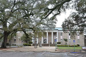
Geneva County is a county of the state of Alabama. Based on the 2010 census, the
population was 26,790. Geneva County was
created on December 26, 1868 and was formed from Coffee County,
Dale County and Henry County. The county seat is Geneva. The
county was named after its county seat, which in turn was named after Geneva, New York which was named after Geneva, Switzerland, by Walter H. Yonge, an early town resident and Swiss native. Geneva County is a prohibition or dry county.
Geneva County is part of the Dothan, AL Metropolitan Statistical Area.
Etymology - Origin of Geneva County Name
Geneva county was named after the town of Genevak that was named for Geneva, Switzerland, by Walter H. Youge, a native of Switzerland, who served as the town's first postmaster. Geneva County is located in southeastern Alabama and is drained by the Choctawhatchee River.
Demographics:
County QuickFacts: CensusBureau Quick Facts
Geneva County History
Geneva County, Alabama
Geneva County formed by the Alabama legislature on 1868 December 26, 1868. The county was named for Geneva, its principal town and county seat. The town of Geneva was named for Geneva, Switzerland, by Walter H. Youge, a native of Switzerland, who served as the town's first postmaster. Geneva County is located in southeastern Alabama and is drained by the Choctawhatchee River. It is bordered by Coffee, Covington, Dale, and Houston counties and the State of Florida. It encompasses 578 square miles. Other towns and communities include Samson and Hartford.
Geography: Land and Water
As reported by the Census Bureau, the county has a total area of 579 square miles (1,500 km2), of which 574 square miles (1,490 km2) is land and 4.5 square miles (12 km2) (0.8%) is water. It is the fifth-smallest county in Alabama by total area.
The Choctawhatchee River flows north to south through the center of the county, and its Hurricane Creek tributary crosses the eastern half of the county. The largest tributary of the Choctawhatchee, the Pea River, and its Flat Creek tributary intersect the western half of the county.
Neighboring Counties
Bordering counties are as follows:
- Northeast: Dale County
- East: Houston County
- Southeast: Jackson County, Fla.
- South: Holmes County, Fla.
- Southwest: Walton County, Fla.
- Northwest: Covington County; Coffee County
Education


Click Image to Enlarge
