


Click Image to Enlarge
Alabama Counties
Alabama currently has sixty-seven counties. The oldest county, Washington, was created on June 4, 1800, when what is now Alabama was then part of the Mississippi Territory. The newest county is Houston, created on February 9, 1903.Shelby County, Alabama History
Shelby County Education, Geography, and History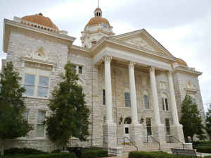
Shelby County is a county of the state of Alabama. Based on the 2010 census, the
population was 195,085. Shelby County was
created on February 7, 1818, from former Creek Indian territory
ceded in the Treaty of Fort Jackson on August 9, 1814 and from
Montgomery County. The county seat is Columbiana. The
county is named in honor of Isaac Shelby, Governor of Kentucky from 1792 to 1796 and again from 1812 to 1816.
Shelby County is included in the Birmingham-Hoover, AL Metropolitan Statistical Area. It ranks among the 100 highest-income counties in the
United States, and is the fastest-growing county in the state. Shelby County's growth has accompanied the stagnation of Birmingham and
Jefferson County.
The county's newspaper is the Shelby County Reporter.
Etymology - Origin of Shelby County Name
The county is named for Isaac Shelby, first governor of Kentucky.
Demographics:
County QuickFacts: CensusBureau Quick Facts
Shelby County History
Shelby County, Alabama
Shelby County was formed by an act of the Alabama Territorial General Assembly on February 7, 1818, from former Creek Indian territory ceded in the Treaty of Fort Jackson on August 9, 1814. It is located in the north-central part of the state and is bounded on the north by Jefferson and St. Clair counties, on the south by Chilton and Bibb counties, on the east by Talladega County and on the west by Bibb and Jefferson counties. About one-half of the counties are in the mineral belt. Shelby County encompasses 800 square miles.
The county is named for Isaac Shelby, first governor of Kentucky. The location of the first county seat was Shelbyville. In 1826 the town of Columbia changed its name to Columbiana and became the permanent county seat. Other towns and communities include: Alabaster, Calera, Pelham, and Montevallo, home of the University of Montevallo.
Shelby County has a long history in agriculture, and since about 1990, it has become an important location for growing soybeans, which has
exceeded cotton as the most important crop grown there.
Shelby County was the home of an early inland waterway, the Coosa River, and it was also the location of a very early east-west railroad in
Alabama that connected Atlanta, Georgia, with locations to its west. Shelby County was also crossed by an early north-south railroad, the
Louisville and Nashville Railroad, that connected Louisville, Nashville, Decatur, Birmingham, and Montgomery.
With the advent of the automobile and the truck, Shelby County was soon crossed from north to south by US Highway 31, the major one that
followed the same route as the Louisville and Nashville Railroad did. (All US Highways, with "one" as their last of two digits are major
north-south ones: e.g. US 11, 21, 31, 41, 51, 61, and 71.) The eastern part of Shelby County was later crossed by US Highway 231 and US
280
Decades later on, Shelby County was crossed by Interstate Highway 65. Hence, an important ingredient in the eventual growth of Shelby County
has been its ready access to modern systems of transportation. Interstate 65 and US Highway 31 have long provided strong connections between
Shelby county and the more populous Jefferson County directly to its north, leading to suburban development in towns such as Pelham, Helena,
Alabaster, and Chelsea.
Geography: Land and Water
As reported by the Census Bureau, the county has a total area of 810 square miles (2,100 km2), of which 785 square miles (2,030 km2) is
land and 25 square miles (65 km2) (3.0%) is water.
Parts of Shelby County are crossed by the southernmost extensions of the Appalachian Mountains, such as Oak Mountain and Double Oak Mountain.
However, large parts of Shelby County are much flatter, giving good land for farms and pastures. Shelby County also has lowlands along two
rivers, and one large man-made reservoir, Lay Lake, which also borders Coosa, Talladega and Chilton counties.
Most of Shelby County is drained either by the Cahaba River, which flows along the northern edge of the county, and then to the southwest, or
by the Coosa River, whose valley includes the eastern end of the county. These are both important rivers in Alabama. Much farther south, both
the Cahaba River and the Coosa River flow into the Alabama River, and thence to the Gulf of Mexico. To be more precise, the Coosa River and
the Tallapoosa River flow together at Wetumpka, Alabama, to form the Alabama River, and then the Cahaba River is a tributary to that one
farther to the west. Waxahatchee Creek, a major tributary of the Coosa River, forms the southeastern portion of the border between Shelby
County and Chilton County.
Neighboring Counties
Bordering counties are as follows:
- Northeast: St. Clair County; Talladega County
- Southeast: Coosa County
- South: Chilton County
- Southwest: Bibb County
- Northwest: Jefferson County
Education
Shelby County Schools operates public schools in the county. Alabaster City Schools operates the six public schools in Alabaster. In 2014, Pelham began operating their own school system with three schools taken over from the Shelby County School System: Pelham High School, Riverchase Middle School, and Valley Elementary School


Click Image to Enlarge
