


Click Image to Enlarge
Alabama Counties
Alabama currently has sixty-seven counties. The oldest county, Washington, was created on June 4, 1800, when what is now Alabama was then part of the Mississippi Territory. The newest county is Houston, created on February 9, 1903.Washington County, Alabama History
Washington County Education, Geography, and History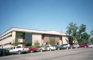
Washington County is a county in the state of Alabama. Based on the 2010 census, the population was 17,581. Washington County was created on June 4, 1800, as a county of the Mississippi Territory. The county seat is Chatom. The county was named in honor of George Washington, the first President of the United States.
Etymology - Origin of Washington County Name
The county was named for George Washington.
Demographics:
County QuickFacts: CensusBureau Quick Facts
Washington County History
Washington County, Alabama
Washington county was formed in June 4, 1800, the county of the Mississippi Territory and its original boundaries were the Chattahoochee River to the east, the Pearl River to the west, the 32nd parallel to the north and the 31st parallel to the south. It currently encompasses 1,081 square miles. Its area originally contained 26,400 square miles. The county was named for George Washington. The area of Washington County was later divided into 16 Mississippi counties and 29 Alabama counties.
Early county seats of Washington County included McIntosh's Bluff, Wakefield and St. Stephens. The county seat is now located at Chatom. The current boundaries of the county include the State of Mississippi to the west, the Tombigbee River to the east, and Mobile County to the south and Choctaw County to the north.
Washington County is the site of St. Stephens, the first territorial capital of Alabama. In 1807 former US Vice President Aaron Burr was
arrested at Wakefield in Washington County, during his flight from being prosecuted for alleged treason (which he was eventually found
innocent of).
Even though the US government removed most of the Choctaw and Creek to Indian Territory (now Oklahoma) west of the Mississippi River in the
1830s, some Native Americans remained behind and become state (and US) citizens. They struggled to maintain their Choctaw culture through
years during which the US government imposed a binary system of diving people into white and "all other" people of color (blacks and
Indians). In 1979 Alabama recognized the MOWA Band of Choctaw Indians. Its members are concentrated along the border of Mobile and Washington
counties.
In the 19th century, the county was largely developed for cotton plantations, with labor supplied by thousands of African-American slaves.
Many were transported by slave traders to the Deep South in a forced migration. During the American Civil War, more than three-fourths of the
adult men in the county were serving in the Confederate Army by 1863. In that year, a group of children petitioned the Confederate government
to avoid drafting more men, so they might serve as a home guard militia. The petition claimed it was needed to against a potential slave
uprising, since there were numerous plantations with large numbers of slaves.
While the county continued to rely on agriculture into the 20th century, the infestation of the boll weevil destroyed many crops.
Mechanization also reduced the need for labor, and thousands of African Americans left the South in the Great Migration to Northern and
Midwestern industrial cities, where they could get better jobs and escape the legal segregation of the South.
The county has gradually developed other businesses and industry, particularly petrochemical. Due to damage from Hurricane Frederic, the
county was declared a disaster area in September 1979.
The county is a dry county, with the exception of Chatom.
Geography: Land and Water
As reported by the Census Bureau, the county has a total area of 1,089 square miles (2,820 km2), of which 1,080 square miles (2,800 km2)
is land and 8.4 square miles (22 km2) (0.8%) is water. This makes Washington County larger than the state of Rhode Island in terms of land
area (but not total area). The county is located approximately 60 miles north of the Gulf of Mexico, and exceeds 682,000 acres of land. About
88 percent of the land area is situated forest and pine plantations.
The Tombigbee River borders Washington County to the east. From the southern point of the river, the boundary runs diagonally south-west,
bisecting the community of Calvert. From there, the southern boundary runs west, roughly following the 31008' N parallel, towards the
Mississippi state line, stopping just short before descending due south into Mobile County and forming part of a rectangle that connects with
the state line. The western boundary is defined by the Alabama-Mississippi state line (approximately 88027' W). The northern boundary runs
west from the state line along the 31041' N parallel until reaching the Tombigbee River.
Neighboring Counties
Bordering counties are as follows:
- North: Choctaw County
- Northeast: Clarke County
- Southeast: Baldwin County
- South: Mobile County
- Southwest: Greene County, Miss.
- Northwest: Wayne County, Miss.
Places of interest
Washington County has three sites listed on the National Register of Historic Places:
- Andrews Chapel in McIntosh
- Old Washington County Courthouse
- Old St. Stephens Site in St. Stephens.
The Washington County Museum is located in the courthouse in Chatom.
Education
The Washington County School system includes:
- Chatom Elementary School
- Fruitdale High School
- Leroy High School
- McIntosh Elementary School
- McIntosh High School
- Washington County High School
- Career Technical Center
- Millry High School


Click Image to Enlarge
