

Click Image to Enlarge
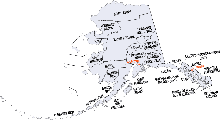
Alaska Boroughs
Alaska is divided into nineteen organized boroughs and one "Unorganized Borough." The Borough Act of 1961 created "The Unorganized Borough" including all of Alaska not within a Unified, Home rule, First class or Second class Borough. The newest borough is Petersburg incorporated after voters approved borough formation in December 2012. Alaska and Louisiana are the only states that do not call their first-order administrative subdivisions counties (Louisiana uses parishes instead)Ketchikan Gateway Borough, Alaska
Ketchikan Gateway Borough Education, Geography, and History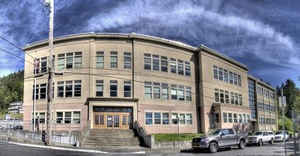
Ketchikan Gateway Borough is a borough located in the state of Alaska. Based on the 2010 census, the
population was 13,477. Ketchikan borough was
created in 1963. The borough seat is Ketchikan. Ketchikan
Gateway Borough was named after Ketchikan Creek, which flows through the town. Ketchikan comes from the Tlingit name for the creek, Kitschk-hin,
which means "spread wings of a prostrate eagle"
Ketchikan Gateway Borough comprises the Ketchikan, AK Micropolitan Statistical Area.
Etymology - Origin of Ketchikan Gateway Borough Name
Ketchikan was named after Ketchikan Creek, which flows through the town. Ketchikan comes from the Tlingit name for the creek, Kitschk-hin, which means "spread wings of a prostrate eagle", which is said to regard to an outlined likeness of this image created by some nearby stream's course.
Demographics:
County QuickFacts: CensusBureau Quick Facts
History of Ketchikan Gateway Borough, Alaska
Ketchikan is Alaska's fifth-largest city in terms of population, and is located in Ketchikan the Gateway Borough. Ketchikan, whose growth is based upon tourism and fishing, is known as the "King Salmon Capital of the World." The Misty Fjords National Monument is one of the area's most major attractions.
Ketchikan was named after Ketchikan Creek, which flows through the town. In Ketchikan, Alaska. Salmon travel up the creek during spawning season to lay their eggs. Ketchikan comes from the Tlingit name for the creek, Kitschk-hin, which means "spread wings of a prostrate eagle", which is said to regard to an outlined likeness of this image created by some nearby stream's course. Ketchikan also has the world's largest collection of standing totem poles located at three major locations: Saxman Village, Totem Bight, and the Totem Heritage Center.
Geography: Land and Water
Ketchikan is located at 55022′52″N, 131039′51″W on Revillagigedo Island, and 90 miles north of Prince Rupert, British Columbia and 235 miles south of Juneau, Alaska.
Around August, 2005 the 2005 Highway Bill provided for about $223 million in subsidies to construct a bridge nearly as long as the Golden Gate Bridge located in California (dubbed by critics as the "Bridge to Nowhere") between Ketchikan and nearby Gravina Island (population: 50). The subsidies were negotiated by Alaska's Rep. Don Young. It was hoped that the bridge would help create a development on the island, which houses the city's airport.
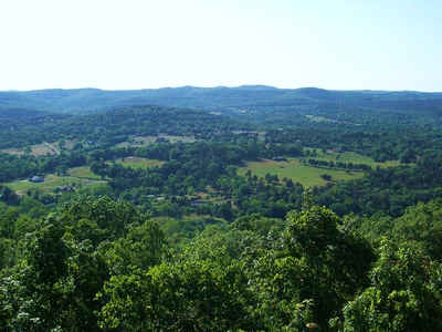
Shaped by the astounding force of massive glaciers millions of years
ago, Alaska's Inside Passage boasts wildlife-filled fjords and lush
island scenery - habitat for whales, porpoises, sea lions, and bald
eagles. The mountains are carpeted with majestic forests. Inside Passage
is home to Tlingit, Haida and Tsimshian Indians whose history is
reflected in towering totem poles. Russian settlers left a legacy of
onion-domed churches gleaming with icons.
In Ketchikan, Alaska. Salmon travel up the creek during spawning season to lay their eggs.
Neighboring Boroughs
Bordering boroughs are as follows:
- Prince of Wales - Outer Ketchikan Census Area, Alaska
Education


Click Image to Enlarge
