

Click Image to Enlarge
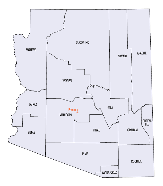
Arizona Counties
There are fifteen Counties in Arizona. There is one defunct county: Pah-Ute County formed in 1865 from Mohave County and returned in 1871. Four Counties (Mohave, Pima, Yavapai and Yuma) were created in 1864 following the organization of the Arizona Territory in 1862. The newest, La Paz County was created in 1983.Cochise County, Arizona
Cochise County Education, Geography, and History
Cochise County is a county located in the southeastern corner of the state of Arizona. The
population was 131,346 at the 2010 census.
The county seat is Bisbee. The county
was formed in 1881. Cochise county is named after Cochise, the Apache Native American leader.
Cochise County comprises the Sierra Vista-Douglas, AZ Metropolitan Statistical Area. The county borders southwestern New Mexico and
northwestern Sonora in Mexico.
Etymology - Origin of Cochise County Name
Cochise is named after Cochise, the Apache Native American leader.
Demographics:
County QuickFacts: CensusBureau Quick Facts
Cochise County History
Cochise County, Arizona
Cochise county was formed apart from Pima County and organized in 1881, and was named for the legendary Apache chief, Cochise, who, with a band of Chiricahuas, made his grip on the Dragoon range of mountains. He pounced down on those who passed along on the plains below and robbed and murdered without mercy. So bold was he in his attacks, and such terror he stirred in all, that no one dared venture within striking distance of the raids of this dreadful mountain outlaw. Indeed, it was not until he was starved out of his stronghold and hanged, that an effort was made to settle up the county or to develop its diverse and prized resources.
In this section of the terrain, prior to the Civil War little was done, save a few settlements on the San Pedro and at minor points. Later the history proper of this county may be said to have begun with the detection of the mines in the Tombstone district in 1878, antedating the organization of the county by the space of three years.
Earlier in 1878, the country beyond the San Pedro was preset over to a domination of the Apache outside of the one traveled wagon road to the east. The grassy plains and hills were bare of cattle, and its mineral treasures were but in the imagination of the curious. In February, 1878, Ed Scheffelin, a prospector, who had trekked much of the territory in vain, stumbled across the droppings of what is now known as the Toughnut mine and located several claims upon the ledge. It was about the time that the Comstocks and Bodie were showing signs of collapse, and the miners of the coast flocked by the hundreds to the new discovery. A city of tents sprung up and by June 1879 a stamp mill was in operation. The mines had not been overrated: they were veritable bonanzas. And (luring their season of activity has produced over $25,000,000, about $5,000,000 of which took the form of dividends to the stockholders. Full $7,000.000 more was spent upon hoisting plants and milling machinery. Up to 1885 was the busy time, when the burning of the hoisting works of the Grand Central mine cast a gloom over the camp, and the water gained upon the miners, and the main properties were closed down for a long season of inactivity. The ore on the lower levels is of high grade, and there yet remain vast quantities of it. But to reach the ore it would be necessary to inaugurate a combination pumping plant that would cost in the neighborhood of $1,000,000, and this expense the mine owners are not inclined to put upon themselves until assured of the future of silver. With a combination of capital the mines will yet be cleared of water, and operations resumed on as grand a scale as ever before.
Prominent men who once held the position of County Sheriff were Johnny Behan, who served as the first sheriff of the new county, and who was one of the main characters during the events leading to and following the Gunfight at the O.K. Corral. Later, in 1886, Texas John Slaughter became sheriff. Lawman Jeff Milton and lawman/outlaw Burt Alvord both served as deputies under Slaughter.
A syndicated television series which aired from 1956 to 1958, Sheriff of Cochise starring John Bromfield, was filmed in Bisbee. The Jimmy Stewart movie Broken Arrow and subsequent television show of the same name starring John Lupton, which also aired from 1956 to 1958, took place (but was not filmed) in Cochise County.
J.A. Jance's Joanna Brady mystery series takes place in Cochise County, with Brady being the sheriff.
Beginning in the late 1950's, the small community of Miracle Valley was the site of a series of bible colleges and similar religious organizations, originally founded by television evangelist A. A. Allen. In 1982, Miracle Valley and neighboring Palominas were the site of a series of escalating conflicts between a newly-arrived religious community and the county sheriff and deputies that culminated in the Miracle Valley shootout.
Geography: Land and Water
As reported by the Census Bureau, the county has a total area of 6,219 square miles (16,110 km2), of which 6,166 square miles (15,970 km2) is land and 53 square miles (140 km2) (0.9%) is water. Cochise County is closely the size of the States of Rhode Island and Connecticut combined.
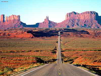
The Chiricahua Mountains are Cochise County's best-known range, but others include the Dragoons and the Whetstones. Between Sierra Vista and Bisbee, the San Pedro Riparian National Conservation Area protects part of the San Pedro River, the last major undammed, free-flowing river in the American Southwest.
Neighboring Counties
Bordering counties are as follows:
- North: Graham County
- Northeast: Greenlee County
- East: Hidalgo County, N.M.
- South: Sonora
- Southwest: Santa Cruz County
- West: Pima County
Education


Click Image to Enlarge
