


Click Image to Enlarge
Arkansas Counties
The first of the Arkansas' seventy-five present-day counties created, Arkansas County was formed on 13 December 1813, when this area was part of the Missouri Territory.Lawrence County, Arkansas
Lawrence County Education, Geography, and History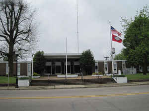
Lawrence County is a county located in the state of Arkansas. Based on the 2010 census, the population was 17,415. The county seat is Walnut Ridge. Lawrence County is Arkansas's second county, formed on January 15, 1815. The county is named for Captain James Lawrence who fought in the War of 1812.
Etymology - Origin of Lawrence County Name
Lawrence county is named for Captain James Lawrence, the naval officer in the War of 1812 who originated the phrase "Don't give up the ship!" James Lawrence (October 1, 1781 - June 4, 1813) was an American naval officer. During the War of 1812, he commanded the USS Chesapeake in a single-ship action against HMS Shannon (commanded by Philip Broke). He is probably best known today for his dying command "Don't give up the ship!", which is still a popular naval battle cry.
Demographics:
County QuickFacts: CensusBureau Quick Facts
Lawrence County History
Lawrence county was formed on January 15, 1815, by the Missouri Legislature, which had jurisdiction over the region until Arkansas became a territory in 1819, the county seat is Walnut Ridge. The county is named for Captain James Lawrence, a naval officer killed in the War of 1812. The economy is made up of agriculture, with rice, soybeans, and milo as leading crops. Cattle, poultry, and light manufacturing also contribute to the economy. There are three highways that make it convenient to ship in and out of the county. Thirty-one of the state's present counties were carved from the original Lawrence County. The original courthouse was at Powhatan and was destroyed by fire in 1885. The archives were saved because they were stored in a stone vault and today they are a part of the Powhatan State Park Museum's regional archive. In 1963 the two districts at Powhatan and Walnut Ridge were consolidated. Some of the oldest records in Arkansas that were written by quill with homemade ink is now stored at the abandoned 1888 courthouse in Powhatan.
The county is an alcohol prohibition or dry county.
Geography: Land and Water
As reported by the Census Bureau, the county has a total area of 592 square miles (1,530 km2), of which 588 square miles (1,520 km2) is land and 4.7 square miles (12 km2) (0.8%) is water.
The landscape of Lawrence County is flat-topped rolling hills in the western half and flat fertile delta river bottomland in the eastern half. The Strawberry, Spring, and Black rivers flow through the county. Lake Charles along with Lake Charles State Park offers fishing, hiking, and picnicking and water sports. The park consists of 645 acres with 96 campsites scattered among the trees. The Shirey Bay-Rainey Brake Wildlife Management Area is a 10,500 acre tract between the Strawberry and Black Rivers and is managed primarily for water fowl. It also has excellent fishing.
Neighboring Counties
Bordering counties are as follows:
- North: Randolph County
- East: Greene County
- Southeast: Craighead County
- South: Jackson County
- Southwest: Independence County
- Northwest: Sharp County
Education
Public education is available from four school districts:
- Hillcrest School District
- Hoxie School District
- Lawrence County School District
- Sloan Hendrix School District


Click Image to Enlarge
