


Click Image to Enlarge
Arkansas Counties
The first of the Arkansas' seventy-five present-day counties created, Arkansas County was formed on 13 December 1813, when this area was part of the Missouri Territory.Ouachita County, Arkansas
Ouachita County Education, Geography, and History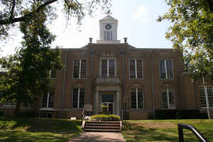
Ouachita County is a county located in the state of Arkansas. Based on the 2010 census, the
population was 26,120. The county
seat is
Camden. The county was formed on November 29, 1842.
Ouachita county is named for the Ouachita River.
Ouachita County is part of the Camden, AR Micropolitan Statistical Area.
Etymology - Origin of Ouachita County Name
Ouachita county is named for the Ouachita River. The river is named for the Washita Indian tribe, which was one of several that lived along the river.
Demographics:
County QuickFacts: CensusBureau Quick Facts
Ouachita County History
Ouachita county was created in November 1842, from part of Union County and named for the river running through it. In the Choctaw language, the words "owa" and "chita" mean "big hunt", from that came Ouachita. It was the river that enticed a French trapper to establish a trading post that would become Camden, the county seat. There use to be heavy steamboat traffic connected Camden directly to New Orleans and other important cities. The county's economy is about half-timber and half manufacturing with some tourism. . Outdoor recreation abounds with hunting, fishing and water sports. The Ouachita County Courthouse has the cornerstone from the 1889 courthouse in the base for a planter in front of the entrance to the present building. The cornerstone refers to the original edifice as "this temple of justice." Also on the lawn is a statue of a woman carrying a flag, erected as a monument to Confederate women, and a Spanish-American War marker.
Geography: Land and Water
As reported by the Census Bureau, the county has a total area of 740 square miles (1,900 km2), of which 733 square miles (1,900 km2) is land and 7.0 square miles (18 km2) (0.9%) is water.
The landscape of the county is rolling hills, largely forested.
Neighboring Counties
Bordering counties are as follows:
- Northeast: Dallas County
- East: Calhoun County
- Southeast: Union County
- Southwest: Columbia County
- West: Nevada County
- Northwest: Clark County
Education


Click Image to Enlarge
