


Click Image to Enlarge
Arkansas Counties
The first of the Arkansas' seventy-five present-day counties created, Arkansas County was formed on 13 December 1813, when this area was part of the Missouri Territory.Searcy County, Arkansas
Searcy County Education, Geography, and History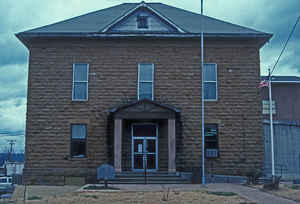
Searcy County is a county located in the state of Arkansas. Based on the 2010 census, the population was 8,195. The county seat is Marshall. The county was formed December 13, 1838, from a portion of Marion County. The county is named for Richard Searcy, the first clerk and judge in the Arkansas Territory. The city of Searcy, Arkansas, some seventy miles away, shares the name despite having never been part of Searcy County.
Etymology - Origin of Searcy County Name
Searcy is named for Richard Searcy a judge in Lawrence County.
Demographics:
County QuickFacts: CensusBureau Quick Facts
Searcy County History
Searcy county was formed in 1838, from a part of Madison County and was named for Richard Searcy, a pioneer in Arkansas Territory. Marshall is the county seat. The Buffalo River, one of the last free-flowing rivers in mid-America, angles across the county with enormous limestone bluffs surrounding the clear blue water of the stream. The Hurricane River Cave has been constantly occupied since ancient times and features a crystal clear underground river that flows through the entire length. Blowing Cave near Marshall has a long corridor where the wind always blows on its way to the surface from a "bottomless pit." Searcy County is proud of its own and celebrates each year with a Buffalo River Days Festival, where arts and crafts and a variety of entertainment are offered. Many visitors pass through Searcy County each year enjoying the beauty and the hometown atmosphere. It is said, that if you enjoy a place of clean streams, clear air, deep caves, tall forests, river bottom farms, and mountainside ranches, you need to visit Searcy County. The county is an alcohol prohibition or dry county.
Geography: Land and Water
As reported by the Census Bureau, the county has a total area of 669 square miles (1,730 km2), of which 666 square miles (1,720 km2) is land and 2.4 square miles (6.2 km2) (0.4%) is water.
The landscape of Searcy County are the rugged Ozark Mountains.
Neighboring Counties
Bordering counties are as follows:
- North: Marion County
- Northeast: Baxter County
- East: Stone County
- Southeast: Van Buren County
- Southwest: Pope County
- West: Newton County
- Northwest: Boone County
Education
Public education is provided for early childhood, elementary and secondary education from multiple school districts including:
- Searcy County School District, which includes Marshall High School
- Ozark Mountain School District, which includes Searcy County-based St. Joe High School and St. Joe Elementary School.


Click Image to Enlarge
