


Click Image to Enlarge
California Counties
The state of California is divided into fifty-eight counties. On January 4, 1850, the California constitutional committee recommended the formation of 18 counties. They were Benicia, Butte, Fremont, Los Angeles, Mariposa, Monterey, Mount Diablo, Oro, Redding, Sacramento, San Diego, San Francisco, San Joaquin, San Jose, San Luis Obispo, Santa Barbara, Sonoma, and Sutter. The last California county to have been established is Imperial County in 1907.California Counties: History and Information
Focused on the histories of California counties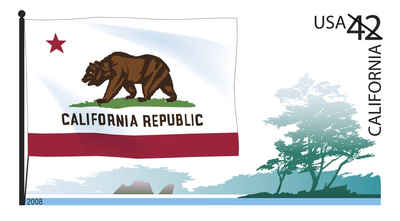
California is located on the West Coast of the United States. It is the most populous state and the third most extensive (after Alaska and Texas). It is home to the nation's second- and sixth-largest census statistical areas (Los Angeles Metropolitan Area and San Francisco Bay Area), and eight of the nation's fifty most populated cities (Los Angeles, San Diego, San Jose, San Francisco, Fresno, Sacramento, Long Beach and Oakland). The capital city is Sacramento.
Creation of the First Eighteen California Counties
On January 4, 1850, a committee of California's first constitutional convention, chaired by General Mariano Vallejo, recommended the creation of eighteen counties. They were Benicia, Butte, Fremont, Los Angeles, Mariposa, Monterey, Mt. Diablo, Oro, Redding, Sacramento, San Diego, San Francisco, San Joaquin, San Jose, San Luis Obispo, Santa Barbara, Sonoma, and Sutter.
The next nine California Counties
Between January 4 and February 18, 1850, the California legislature added nine counties to the list recommended by General Vallejo's committee, some of the changes based on additional recommendations by the committee. The nine added counties were Branciforte, Calaveras, Coloma, Colusi, Marin, Mendocino, Napa, Trinity, and Yuba. This brought the total number of counties to 27. The legislature also approved several name changes. Benicia was renamed El Dorado, Fremont was renamed Yola, Mt. Diablo was renamed Contra Costa, San Jose was renamed Santa Clara, Oro was renamed Tuolumne, and Redding was renamed Shasta.
Most of California's counties were named by Spanish explorers, often for a Roman Catholic saint whose feast day intersected with the advance into a new part of Alta California. Native American names are also represented, with a smattering of counties named for local figures from the early American era. Many counties are named after Spanish missions.
Effective February 18, 1850, twenty-seven counties were created in California. The new counties were Branciforte, Butte, Calaveras, Colusi, Contra
Costa, El Dorado, Los Angeles, Marin, Mariposa, Mendocino, Monterey, Napa, Sacramento, San Diego, San Francisco, San Joaquin, San Luis Obispo, Santa
Barbara, Santa Clara, Solano, Sonoma, Sutter, Trinity, Tuolumne, Yola, and Yuba.
In early 1850, not long after the legislature adopted its first statute creating counties, new statutes were adopted changing some county names. Branciforte
was changed to Santa Cruz, Colusi was changed to Colusa, and Yola was changed to Yolo.
On September 9, 1850, California became the State of California with the same twenty-seven counties.
The last California county to have been established is Imperial County in 1907.
| Focused on the histories of California Counties | ||||
|---|---|---|---|---|
| County | 2000 Population |
Square Miles |
County Seat | Created |
| Alameda County | 1,443,741 | 738 | Oakland | 1853 |
| Alpine County | 1,208 | 739 | Markleeville | 1864 |
| Amador County | 35,100 | 593 | Jackson | 1854 |
| Butte County | 203,171 | 1,640 | Oroville | 1850 |
| Calaveras County | 40,554 | 1,020 | San Andreas | 1850 |
| Colusa County | 18,804 | 1,151 | Colusa | 1850 |
| Contra Costa County | 948,816 | 720 | Martinez | 1850 |
| Del Norte County | 27,507 | 1,008 | Crescent City | 1857 |
| El Dorado County | 156,299 | 1,712 | Placerville | 1850 |
| Fresno County | 799,407 | 5,963 | Fresno | 1856 |
| Glenn County | 26,453 | 1,315 | Willows | 1891 |
| Humboldt County | 126,518 | 3,573 | Eureka | 1853 |
| Imperial County | 142,361 | 4,175 | El Centro | 1907 |
| Inyo County | 17,945 | 10,192 | Independence | 1866 |
| Kern County | 661,645 | 8,142 | Bakersfield | 1866 |
| Kings County | 129,461 | 1,390 | Hanford | 1893 |
| Lake County | 58,309 | 1,258 | Lakeport | 1861 |
| Lassen County | 33,828 | 4,558 | Susanville | 1864 |
| Los Angeles County | 9,519,338 | 4,060 | Los Angeles | 1850 |
| Madera County | 123,109 | 2,138 | Madera | 1893 |
| Marin County | 247,289 | 520 | San Rafael | 1850 |
| Mariposa County | 17,130 | 1,451 | Mariposa | 1850 |
| Mendocino County | 86,265 | 3,509 | Ukiah | 1850 |
| Merced County | 210,554 | 1,929 | Merced | 1855 |
| Modoc County | 9,449 | 3,944 | Alturas | 1874 |
| Mono County | 12,853 | 3,044 | Bridgeport | 1861 |
| Monterey County | 401,762 | 3,322 | Salinas | 1850 |
| Napa County | 124,279 | 754 | Napa | 1850 |
| Nevada County | 92,033 | 958 | Nevada City | 1851 |
| Orange County | 2,846,289 | 790 | Santa Ana | 1889 |
| Placer County | 248,399 | 1,404 | Auburn | 1851 |
| Plumas County | 20,824 | 2,554 | Quincy | 1854 |
| Riverside County | 1,545,387 | 7,208 | Riverside | 1893 |
| Sacramento County | 1,223,499 | 966 | Sacramento | 1850 |
| San Benito County | 53,234 | 1,389 | Hollister | 1874 |
| San Bernardino County | 1,709,434 | 20,062 | San Bernardino | 1853 |
| San Diego County | 2,813,833 | 4,204 | San Diego | 1850 |
| San Francisco City & County | 776,733 | 47 | San Francisco | 1850 |
| San Joaquin County | 563,598 | 1,399 | Stockton | 1850 |
| San Luis Obispo County | 246,681 | 3,304 | San Luis Obispo | 1850 |
| San Mateo County | 707,161 | 449 | Redwood City | 1856 |
| Santa Barbara County | 399,347 | 2,738 | Santa Barbara | 1850 |
| Santa Clara County | 1,682,585 | 1,291 | San Jose | 1850 |
| Santa Cruz County | 255,602 | 446 | Santa Cruz | 1850 |
| Shasta County | 163,256 | 3,786 | Redding | 1850 |
| Sierra County | 3,555 | 953 | Downieville | 1852 |
| Siskiyou County | 44,301 | 6,287 | Yreka | 1852 |
| Solano County | 394,542 | 828 | Fairfield | 1850 |
| Sonoma County | 458,614 | 1,576 | Santa Rosa | 1850 |
| Stanislaus County | 446,997 | 1,495 | Modesto | 1854 |
| Sutter County | 78,930 | 603 | Yuba City | 1850 |
| Tehama County | 56,039 | 2,951 | Red Bluff | 1856 |
| Trinity County | 13,022 | 3,179 | Weaverville | 1850 |
| Tulare County | 368,021 | 4,824 | Visalia | 1852 |
| Tuolumne County | 54,501 | 2,236 | Sonora | 1850 |
| Ventura County | 753,197 | 1,846 | Ventura | 1873 |
| Yolo County | 168,660 | 1,012 | Woodland | 1850 |
| Yuba County | 60,219 | 630 | Marysville | 1850 |

Click Image to Enlarge
