


Click Image to Enlarge
California Counties
The state of California is divided into fifty-eight counties. On January 4, 1850, the California constitutional committee recommended the formation of 18 counties. They were Benicia, Butte, Fremont, Los Angeles, Mariposa, Monterey, Mount Diablo, Oro, Redding, Sacramento, San Diego, San Francisco, San Joaquin, San Jose, San Luis Obispo, Santa Barbara, Sonoma, and Sutter. The last California county to have been established is Imperial County in 1907.Calaveras County, California
Calaveras County Education, Geography, and History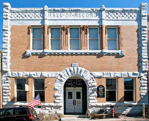
Calaveras County, officially the County of Calaveras, is a county located in the state of California. Based on the 2010 census, the population was 45,578. The county seat is San Andreas, and Angels Camp is the only incorporated city. Calaveras is the Spanish word for skulls; the county was reportedly named for the remains of Native Americans discovered by the Spanish explorer Captain Gabriel Moraga. In 1850, Calaveras county was created.
Etymology - Origin of Calaveras County Name
The meaning of the word calaveras is "skulls." This county takes its name from the Calaveras River, which was reportedly so designated by an early explorer when he found, on the banks of the stream, many skulls of Indians who had either died of famine or had been killed in tribal conflicts over hunting and fishing grounds.
Demographics:
County QuickFacts: CensusBureau Quick Facts
Calaveras County History
Calaveras County, one of the original 27 counties of the State, was organized at the 1849-50 session of the
California State Legislature. At one time it embraced a portion of Amador, Alpine and Mono Counties. In 1854, Amador
County was created from Calaveras and El Dorado counties, and parts of Calaveras County was taken to form Fresno County
in 1856, Mono County in 1861 and Alpine County in 1864.
Calaveras is a Spanish word meaning skull. This name was first given to the river because of the great quantities of
human skulls found along the lower reaches of the river.
The first officers of the county were: William Fowle Smith, County Judge; Colonel Collier, County Clerk; A. B. Mudge,
Treasurer; H. A. Carter, Prosecuting Attorney. Pleasant Valley, better known as Double Springs, was designated as the
first county seat. Court was first held in a large tent, and later a small court house was erected from camphor wood
imported from China. The old building is still standing at Double Springs. The county seat was moved to Jackson in 1850
where it remained until 1852. (Jackson was at that time in Calaveras County.) In 1852 the county seat of Calaveras
county was moved to Mokelumne Hill where it remained until 1863. After an election in 1863 San Andreas was declared to
be the county seat. Legal action followed this election, and it was not until 1866 that the county seat was actually
moved to San Andreas where it has since remained.
The Calaveras Chronicle, the first weekly newspaper published in California, was first published on October 28, 1851, at
Mokelumne Hill.
The first grove of Big Trees, "Sequoia Gigantea," discovered in California was the Calaveras Grove of Big Trees. These
were located in 1852 by A. T. Dowd, a hunter for the Union Water Company which was at that time building an aqueduct
from the Stanislaus River to Murphys.
The largest gold nugget found in the United States was taken from the Morgan Mine at Carson Hill in November, 1854. When
weighed on Adams Express Company's gold scales in Stockton, it balanced the scales at 214 pounds and eight ounces.
The first three story building erected in the interior of California was in Mokelumne Hill.
Calaveras County is famous for its lode and placer mines. For many years it was the principal copper producing
county in California. Cement production from its vast limestone deposits has become one of the county's major industries
in recent years.
The following places were early day mining communities: Angels Camp, Fourth Crossing, Mokelumne Hill, Calaveritas, Old
Gulch, Douglas Flat, Vallecito, Murphys, Sheep Ranch, San Antone, Rich Gulch, Campo Seco, Copperopolis, West Point,
Glencoe, Middle Bar, Carson Hill, Robinson's Ferry, Jesus Maria, Mountain Ranch, El Dorado, North Branch, Camanche,
Railroad Flat, Blue Mountain City, Telegraph City, Petersburg, Gwin Mine and Jenny Lind.
John W. Robinson and Stephen Mead were licensed by the Court of Sessions of Calaveras county on August 13, 1850 to
maintain a ferry on the Stanislaus River at Robinson's Ferry. L. Martin and Aristede L. Pench were licensed to maintain
a ferry at Middle Bar on the Mokelume River on June 5, 1850 by the Court of Sessions of Calaveras County.
Geography: Land and Water
As reported by the Census Bureau, the county has a total area of 1,037 square miles (2,685 km2), of which, 1,020 square miles (2,642 km2) of it is land and 17 square miles (44 km2) of it (1.62%) is water.
A California Department of Forestry report lists the county's area in acres as 663,000, although
the exact figure would be 663,477.949 acres (2,685.00000 km2). There are a number of caverns located in
Calaveras County.
Neighboring Counties
Bordering counties are as follows:
- Northeast: Alpine County
- Southeast: Tuolumne County
- Southwest: Stanislaus County; San Joaquin County
- Northwest: Amador County
Education


Click Image to Enlarge
