


Click Image to Enlarge
California Counties
The state of California is divided into fifty-eight counties. On January 4, 1850, the California constitutional committee recommended the formation of 18 counties. They were Benicia, Butte, Fremont, Los Angeles, Mariposa, Monterey, Mount Diablo, Oro, Redding, Sacramento, San Diego, San Francisco, San Joaquin, San Jose, San Luis Obispo, Santa Barbara, Sonoma, and Sutter. The last California county to have been established is Imperial County in 1907.Inyo County, California
Inyo County Education, Geography, and History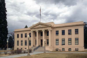
Inyo County is a county located in the state of California. Based on the 2010 census, the population was 18,546. The county seat is Independence. Inyo County was formed on March 22, 1866 from Mono County and Tulare County. Inyo county is named for Indian name for the mountains in its area. The meaning of the word inyo is "dwelling place of the great spirit."
Etymology - Origin of Inyo County Name
This county derived its name from the Indian name for the mountains in its area. The meaning of the word inyo is "dwelling place of the great spirit."
Demographics:
County QuickFacts: CensusBureau Quick Facts
Inyo County History
Inyo county derived its name from the Native American name for the mountains in its area. The meaning of the word inyo is "dwelling place of the great spirit."
Present day Inyo county has been the historic homeland for thousands of years of the Mono tribe, Coso people, Timbisha, and Kawaiisu
Native Americans. They spoke the Timbisha language and the Mono language with Mono traditional narratives. The descendants of these
ancestors continue to live in their traditional homelands in the Owens River Valley and in Death Valley National Park.
Inyo County was formed in 1866 from the territory of the unorganized Coso County created on April 4, 1864 from parts of Mono and Tulare
Counties. It acquired more territory from Mono County in 1870 and Kern County and San Bernardino County in 1872.
It has been commonly believed that the county got its name from the
Mono tribe of Native Americans name for the mountains in its former
homeland. The name came to be thought of, mistakenly, as the name of the mountains to the east of the
Owens Valley when the first whites there asked the local Paiutes what the name of the mountains to the east was.
The local Paiutes responded that that was the land of Inyo. They meant by this that those lands belonged to the Shoshone tribe headed by a
man whose name was Inyo. Inyo was the name of the headman of the Panamint band of Paiute-Shoshone people at the time of contact when the
first whites, the Manly expedition of 1849, wandered, lost, into Death Valley on their expedition to the gold fields of western
California. The Owens Valley whites misunderstood the local Paiute and thought that Inyo was the name of the mountains when actually it
was the name of the chief, or headman, of the tribe that had those mountains as part of their homeland.
"Indian George", a fixture of many of the stories of early Death Valley days, was Inyo's son. Indian George's Shoshone name was
"Bah-Vanda-Sa-Va-Nu-Kee", which means "The Boy Who Ran Away", a name he was given when he became
frightened of the whites and their wheeled
wagons and huge buffalo. The Shoshone had ever seen before when they came
traveling down Furnace Creek Wash in December
1849. In 1940, when Bah-vanda was around 100 years old, JC Boyles, a Panamint Shoshone who had become educated, came back to the Panamint
Valley and interviewed Bah-Vanda at length about the early days of his life, including the events of 1849, and it is in this interview
(which can be found in February 1940 issue of The Desert Magazine) that Bah-vanda refers to his father, Inyo.
Water was diverted from the Owens River into the Los Angeles Aqueduct
in 1913, in order to deliver water needed for the growing City of
Los Angeles. The Owens River Valley cultures and environments changed
considerably. From the 1910s to 1930s the Los Angeles Department of
Water and Power purchased much of the valley for water rights and control. In 1941 the Los Angeles Department of Water and Power extended
the Los Angeles Aqueduct system further upriver into the Mono Basin.
Find more at Pioneers: Inyo County - History
Geography: Land and Water
As reported by the Census Bureau, the county has a total area of 10,227 square miles (26,488 km2), of which 10,203 sq mi (26,426 km2) is land and 24 sq mi (62 km2) is water. Relatively, it is a very large county. It is the second largest in California and the tenth largest in the nation (excluding boroughs and census areas in Alaska).
Inyo County is located on the east side of the Sierra Nevada and southeast of Yosemite National Park in Central California. It contains
the Owens River Valley; it is flanked to the west by the Sierra Mountains and to the east by the White Mountains and the Inyo Mountains.
Mount Whitney, the highest peak in the Continental United States, is on Inyo County's western border (with Tulare County). The Badwater
Basin in Death Valley National Park, the lowest place in North America, is in eastern Inyo County. The two points are not visible from
each other, but both can be observed from the Panamint Range on the west side of Death Valley, above the Panamint Valley.
Neighboring Counties
Bordering counties are as follows:
- North: Esmeralda County, Nev.
- Northeast: Nye County, Nev.
- East: Clark County, Nev.
- Southeast: San Bernardino County
- Southwest: Kern County; Tulare County
- West: Fresno County
- Northwest: Mono County
Education
School districts in Inyo County are:
- Big Pine Unified School District
- Bishop Joint Union High School District
- Bishop Union Elementary School District
- Death Valley Unified School District
- Lone Pine Unified School District
- Owens Valley Unified School District
- Round Valley School District
Deep Springs College is a two-year alternative education college in Deep Springs Valley.


Click Image to Enlarge
