


Click Image to Enlarge
California Counties
The state of California is divided into fifty-eight counties. On January 4, 1850, the California constitutional committee recommended the formation of 18 counties. They were Benicia, Butte, Fremont, Los Angeles, Mariposa, Monterey, Mount Diablo, Oro, Redding, Sacramento, San Diego, San Francisco, San Joaquin, San Jose, San Luis Obispo, Santa Barbara, Sonoma, and Sutter. The last California county to have been established is Imperial County in 1907.Kings County, California
Kings County Education, Geography, and History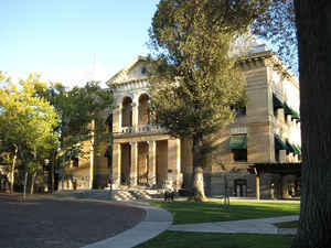
Kings County is a county located in the state of California. Based on the 2010 census, the
population was 152,982. The county
seat is
Hanford. The county was formed on March 22, 1893, out
of a part of Tulare County; approximately 100 square miles of territory
from Fresno County was added in 1908. Kings county is
named for Kings River, original Spanish name Rio de los Santos
Reyes ("River of the Holy Kings").
Kings County comprises the Hanford-Corcoran, CA Metropolitan Statistical Area, which is also included in the Visalia-Porterville-Hanford, CA
Combined Statistical Area. The county is located in the San Joaquin Valley, a rich agricultural region.
Etymology - Origin of Kings County Name
The county was created out of a part of Tulare County; some 100 square miles of territory from Fresno County was added in 1908. It derived its name from the Kings River which, according to Padre Munoz' diary of the Moraga Expedition of 1806, was discovered in 1805 by an exploring expedition and named Rio de los Santos Reyes (River of the Holy Kings).
Demographics:
County QuickFacts: CensusBureau Quick Facts
Kings County History
Kings County was formed in 1893 from the western part of Tulare County. In 1909 a triangular area of 118 square miles (306 km2) was taken from Fresno County and added to Kings County
Historical Overview of Kings County California
Prepared by Jeff Crosby, Kings County Library
Kings county is located in the south central San Joaquin Valley, Kings County, California has remained a
main
agricultural area since its first settlement in the 1850s. The elevation varies from 250 feet at the
county seat in Hanford to 775 feet in the west side community of Avenal. The climate is dry and mild in
the winter, with the high temperature ranging from 55 to 65 degrees. Fog is not uncommon during the
winter months, and can settle in for periods of up to two weeks. The summers are hot, with an average
high temperature of 97 or 98 degrees in July and August. Annual precipitation is approximately 10
inches, most of the rain falling between November and April.
When the first white settlers arrived, the indigenous population consisted of the Tache tribe of the
Yokut Indians. The Yokuts controlled the entire San Joaquin Valley, from the Delta to Tejon Pass. There
is no history of Indian troubles in the county as the Tache tribe was not belligerent, and has continued
to live in the region.
The first settlement was a ferry situated on the south bank of the Kings River where the Overland Stage
route crossed. Known as Kingston, this town was the only settlement on the stage route between Stockton
and Visalia. Kingston was part of Tulare County (which had been incorporated in 1851). A bridge replaced
the ferry in 1873, and the town went into decline. By the 1890s Kingston was abandoned.
A few small settlements followed, but the first incorporated community was Lemoore. The town site was
surveyed by Dr. Lovern Lee Moore in 1872. The success of the town was assured with the arrival of the
Southern Pacific railroad in 1877. The second permanent community was begun in 1877 along the railroad
tracks at the site of Perry Phillip's sheep camp. Named for James Madison Hanford, the paymaster of the
Southern Pacific, the second town was incorporated in 1891. Hanford became the county seat two years
later, when Kings county was formed from the western half of Tulare County.
While the arrival of the railroad bolstered the economies of the local communities, it also led to
conflict. In 1880 a group of settlers who had laid claim to land designated as part of the Southern
Pacific right-of-way openly opposed the prices being affixed to the land by the railroad. The conflict
climaxed in a gun battle between settlers and federal marshals at the Henry D. Brewer homestead on 11
May 1880. Seven men were killed and eight wounded during what has become known as the Mussel Slough
tragedy. This even led to legal reform regarding railroad lands and settlement policies.
The early economy of the county was centered around ranching and farming. The first vineyard was
established in 1890 and grapes continue to be an important crop in the region. The first dairy came
three years later in 1893. Dairy farming continues to be a major part of the Kings County economy. In
addition, cotton, fruit, and nuts have all become important crops in the region.
Settlement in Kings County remained modest throughout much of the county's first century. The third
incorporated community, Corcoran, was established on the San Francisco and San Joaquin Railroad in 1905.
The fourth incorporated town, Avenal, was established in 1929 on the west side after oil was discovered
in the hills. A number of unincorporated communities also exist, including Armona, Grangeville, Kettleman
City and Stratford. The county population was 35,100 in 1940. The population rose to 73,700 by 1980.
Today, Kings County remains primarily an agricultural area. The county has four incorporated
communities, Avenal, Corcoran, Hanford and Lemoore. In 1996 the population of the county was estimated
to be 118,000. The largest community is Hanford, with a population over 38,000. Kings County is also
home to the Lemoore Naval Air Station and three California State Correctional facilities, two in
Corcoran and one in Avenal.
Sources:
Brown, J. L. The Mussel Slough Tragedy. n. p., 1958.
Cody , Evan & Clark , Jay (eds.). Kings County: A Short History. Hanford, California: Kings County
Historical Society, 1987.
Cummins, Marjorie W. The Tache-Yokuts: Indians of the San Joaquin Valley. Fresno, California: Pioneer
Publishing, 1979.
Kings County: A Pictorial History. Hanford, California: Kings County Centennial Committee, 1992.
Geography: Land and Water
As reported by the Census Bureau, the county has a total area of 1,391 square miles (3,604 km2),
of which, 1,391 square miles (3,603 km2) of it is land and 0 square miles (1 km2) of it (0.04%) is
water.
Kings County is bordered on the north and northwest by Fresno County, on the east by Tulare County, on
the south by Kern County and a small part of San Luis Obispo County and on the west by Monterey County.
Most of the historic Tulare Lake was within Kings County. Although reclaimed for farming late in the
19th century, it was once was considered to be the largest freshwater lake west of the Great Lakes.
Neighboring Counties
Bordering counties are as follows:
- North: Fresno County
- East: Tulare County
- Southeast: Kern County
- Southwest: San Luis Obispo County
- West: Monterey County
Education


Click Image to Enlarge
