


Click Image to Enlarge
California Counties
The state of California is divided into fifty-eight counties. On January 4, 1850, the California constitutional committee recommended the formation of 18 counties. They were Benicia, Butte, Fremont, Los Angeles, Mariposa, Monterey, Mount Diablo, Oro, Redding, Sacramento, San Diego, San Francisco, San Joaquin, San Jose, San Luis Obispo, Santa Barbara, Sonoma, and Sutter. The last California county to have been established is Imperial County in 1907.Nevada County, California
Nevada County Education, Geography, and History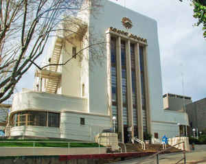
Nevada County is a county located in the Sierra Nevada of California. Based on the 2010 census, the
population was 98,764. The county
seat is
Nevada City. Nevada county was created April 25, 1851.
The county is named after the mining town of Nevada
City, a name derived from the term "Sierra Nevada."The word nevada in
Spanish means "snowy"or "snowcovered."
Nevada County comprises the Truckee-Grass Valley, CA Micropolitan Statistical Area, which is also included in the Sacramento-Roseville, CA
Combined Statistical Area. It is located in the Mother Lode Country.
Etymology - Origin of Nevada County Name
Named after the mining town of Nevada City, a name derived from the term "Sierra Nevada." The word nevada in Spanish means "snowy" or "snowcovered."
Demographics:
County QuickFacts: CensusBureau Quick Facts
Nevada County History
Nevada County was created in 1851 from parts of Yuba County.
A BRIEF HISTORY OF NEVADA COUNTY
By Ed Tyson
Nevada County was organized by an act of the legislature, approved May 18, 1851. Before that time it had
been a part of Yuba County, but the growth of population and business following the gold rush of 1849-50
plus the distance of the courts for trial of important criminal and civil business, resulted in the move
for a separate county organization.
The earliest settlement in Nevada County was made in the summer of 1848 at a place called Rose's Corral
which was located between the Anthony House and Bridgeport. Early in the spring of 1849 a group of
mountaineers from Oregon known as the Greenwood Company mined for gold at Illinois Bar on the South Yuba
River. They were followed by emigrants from Indiana. In the fall of 1849, the Greenwood Company made
winter camp at Jefferson, and the Indiana group moved further upstream to Washington. It was that same
autumn that Captain John Pennington's party struck rich diggings on Deer Creek and built the first cabin
on Gold Run, the site that was to become Nevada City.
By late August, 1850, Washington was the highest point on the South Yuba at which gold had been
discovered, and a large population grew around the town as well as at the town of Jefferson.
Water was one of the most important agents for developing the resources of the county, and ditches for
transporting water became indispensable to the miners. The first such ditch, in March 1850, brought
water from Mosquito Creek to Coyote Hill, a distance of a mile and a half. Another ditch in May, 1850,
took water from Deer Creek to Phelps Hill a short distance away.
In August, 1850, a man named Moore began a ditch designed to take water from Deer Creek, just above
Nevada City, to Rough and Ready. After completing only one mile of his ditch, Moore was forced to give
up his project. The following January, A. L. and B. O. Williams succeeded in getting the water ditch
completed, a distance of thirteen miles.
By 1867, the total length of ditches in the county had reached 850 miles at a cost of construction of
$4,250,000. The two leading systems were the Eureka Lake and Yuba Canal Company and the South Yuba Canal
Company. By 1880 there were more than 1000 miles of ditches, and construction costs had reached
$7,000,000. It was the elaborate ditch systems that made hydraulic mining possible. This form of mining
dominated all other methods of obtaining gold until it was stopped by court order in 1884. Today that
network of ditches have been absorbed by the Nevada Irrigation District, with some of the old ditches
still in use.
The deep quartz mines or "hard rock" mines, some of which date back to 1850, produced huge amounts of
gold. Notable mines were the Empire, Idaho-Maryland, North Star, Pennsylvania, Allison Ranch, Work-Your-
Own-Diggings, Golden Center, Spring Hill, Murchie, Champion, Providence, Fortuna, and Banner Lava Cap.
The first gold was hauled out of the county by stage coach, the property of the early express companies.
One of the most famous of these was Wells Fargo. Later, when the Central Pacific Railroad was built, the
Nevada County Narrow Gauge connected Nevada City and Grass Valley to that transportation giant at
Colfax.
Today in Nevada County traces of the past can be found everywhere. A visit to Grass Valley will revive
memories of the stories about Lola Montez, Lotta Crabtree, and John Rollin Ridge. Alonzo Delano (Old
Block), relative of President Franklin Roosevelt, left his mark here; John Hays Hammond mined here. In
Nevada City, just over Sugar Loaf, is located the Selby Flat and Rock Creek area so vividly portrayed in
Canfield's Diary of a Forty-Niner. Local hero Henry Meredith is buried beneath an imposing monument in
the Pioneer Cemetery. The beautiful southern mansion of Nevada's bonanza-days senator, William Morris
Stewart, stands on Piety Hill. On Main Street, the old assay office where Comstock ore was first tested
still stands. A former President, Herbert Hoover, once mined here.
Interested tourists can still visit Rough & Ready (Republic for a month), You Bet, Red Dog, Gouge Eye,
Walloupa, Chalk Bluff, Washington, Jefferson, Alpha and Omega, up through Gaston Ridge, through Bloody
Run, and God's Country. At the top of the Sierra there still exist the site of Meadow Lake. In the
Meadow Lake Cemetery is the grave of Henry Hartley whose gold discoveries started one of the most
picturesque and short-lived boom towns in history.
By the end of the nineteenth century California had been discovered by artists and writers, attracted to
the magnificent landscapes and natural beauty of the state and to the fascinating spectacle of rapid
social and economic change. This was felt in Nevada County as elsewhere throughout the state. For the
interested reader, numerous excellent reading lists exist for guidance into any phase of our history.
And for the reader who has time, nothing can be more rewarding than browsing through the old newspapers.
Newspaper files dating from 1851 to the present are available in the Nevada County Public Library.
Geography: Land and Water
As reported by the Census Bureau, the county has a total area of 974 square miles (2,524 km2), of
which, 958 square miles (2,480 km2) of it is land and 17 square miles (44 km2) of it (1.73%) is water.
Nevada County is located in the foothills of the Sierra Nevada
Mountains. The western part of the county is defined by the course of several rivers and the irregular boundaries
of adjoining counties. The final shape of the county closely resembles the Deringer pocket pistol, a favorite at the time of the more urbane residents of this gold rush county.
Neighboring Counties
Bordering counties are as follows:
- Northeast: Washoe County, Nev.; Sierra County
- South: Placer County
- West: Yuba County
Education


Click Image to Enlarge
