


Click Image to Enlarge
California Counties
The state of California is divided into fifty-eight counties. On January 4, 1850, the California constitutional committee recommended the formation of 18 counties. They were Benicia, Butte, Fremont, Los Angeles, Mariposa, Monterey, Mount Diablo, Oro, Redding, Sacramento, San Diego, San Francisco, San Joaquin, San Jose, San Luis Obispo, Santa Barbara, Sonoma, and Sutter. The last California county to have been established is Imperial County in 1907.Shasta County, California
Shasta County Education, Geography, and History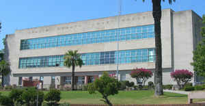
Shasta County, officially the County of Shasta, is a county located in the northern portion of the state of California. Based on the 2010 census, the population was 177,223. The county
seat is Redding. The county was created
February 18, 1850. This county is named after Mount
Shasta
Shasta County comprises the Redding, California Metropolitan Statistical Area. The county occupies the northern reaches of the Sacramento
Valley, with portions extending into the southern reaches of the Cascade Range.
Etymology - Origin of Shasta County Name
This county was named after Mount Shasta. The name Shasta is derived from the English equivalent for the name of an Indian tribe that once lived in the area. The name of the tribe was spelled in various ways until the present version was used when the county was established.
Demographics:
County QuickFacts: CensusBureau Quick Facts
Shasta County History
Shasta County was one of the original counties of California, created in 1850 at the time of statehood. Parts of the county's territory were given to Siskiyou County in 1852, and to Tehama County in 1856.
Shasta County History
By Dottie Smith
Shasta County history begins with the Indians, the first inhabitants. When white men began arriving
in the early 1800's, five tribes were living here, each in their own territory. They were the Achomawi,
Atsugewi, Okwanuchu, Wintu and the Yana. The first white men seen by Indians were Russians who came from
the north moving southward through the Sacramento River Canyon in approximately 1815. The next white men
were Spanish soldiers who traveled here from the southern missions. Then came American, British, and
French trappers and explorers traveling into and through this area beginning in the late 1820s in large
parties of between 50 and 100 people, which included their wives and children. The Indians relationship
with the trappers was good, so good in fact, that trapper Michel LaFramboise supposedly married an
Indian woman in each tribe to solidify his good relations. Most of the trappers worked for the Hudson's
Bay Company whose headquarters was located at Fort Vancouver on the Colombia River in Oregon and were
sent here to trap mainly the beaver whose pelts brought top dollar and were used to make beaver hats,
the rage of the day.
These trappers established and mapped the first trails into, around, and through what is now Shasta
County. However, unrestricted trapping eventually caused the depopulation and near extermination of the
beavers and the end of trapping in the 1840s. But before it did, disaster was innocently brought to the
Indians in 1832 by John Work and his party who were unknowingly infected with either malaria or
influenza. The Indians contracted the disease which resulted in a catastophic epidemic that killed
hundreds (possibly thousands) of Indians and wiped out entire villages. Journals of later trappers told
of coming upon abandoned villages whose grounds were strewn with bones and skulls. It is believed this
epidemic was so severe and deadly it greatly reduced their populations and made the Gold Rush and
subsequent white settlement easier to accomplish.
In 1844, Pierson B. Reading, Lansford B. Hastings, and William Bennitz had all arrived upon the scene
and had all applied for free land in the form of land grants from Mexico, who at that time controlled
and claimed ownership of California. Of the three, Reading and Bennitz' requests were granted. Hastings
request for all the upper Sacramento River Canyon area was denied because he refused to give up his
United States citizenship to become a Mexican citizen (a stipulation required in order to receive a land
grant). Bennitz' land grant, however, on the east side of the Sacramento River opposite Reading's grant,
was never confirmed because he never claimed it. Pierson B. Reading's request was granted and he became
the recipient of a 26,632 acre Mexican land grant (Rancho Buena Ventura) whose boundaries extended from
Cottonwood Creek on the south to Salt Creek on the north, and extended approximately three miles west of
the Sacramento River the length of the grant. Reading settled on his grant in 1847, and when he did,
became the second known white resident in what was to become Shasta County.
The first known resident was Lansford Hastings who settled at the foot of Castle Crags beside Lower Soda
Springs in 1844. In 1848 gold was discovered at Coloma in the tailrace of John Sutter's sawmill and
Reading went to see. He returned to his grant believing gold to be there also because of the
similarities in the terrain, and with the help of his Indian laborers, discovered gold in Clear Creek,
five miles from its mouth, at the place known today as Reading's Bar, and began working the deposits.
And the rest is history.
By 1849 the Gold Rush was in full swing and Reading had lots of new neighbors. The 'yellow fever' had
brought men rushing here from all around the world. Transportation was at first unavailable and
nonexistent in this area, so the miners arrived here any way they could. Some walked overland from
Humboldt Bay, others took passage on ships to San Francisco Bay, then rode stagecoaches as far north as
Sacramento or Marysville, and walked the rest of the way. Others arrived in wagon trains pulled by oxen
and/or horses or mules from the midwest. The fever grew to such epidemic proportions that officers and
crews abandoned their ships in San Francisco Harbor to join in the rush to the northern goldfields. The
result left San Francisco Harbor full of empty, ghostly ships, swaying and creaking to the rhythm of the
waves.
Shasta soon became the most important commercial center in all of northern California, with Horsetown
(located beside Clear Creek at the site of Reading's gold discovery) and Lower Springs (two miles
southeast of Shasta) both running a close second. Prospectors overran the entire area, laws were
nonexistent, living conditions were mostly deplorable, and housing consisted of lean-to's, tents, and a
few log cabins. Every nook and cranny was checked for gold - it could be said the miners turned the area
inside out in their mad search for the elusive yellow metal.
Various types of mining methods were used to collect the gold, beginning with panning and graduating to
sluice boxes, Long Toms, rockers and cradles, hydraulicking, dredging, and drift mining. Most of the
miners staked a claim, worked it until it gave out, and then moved on to another claim. Eventually the
Gladstone, Washington, Walker, and Mad Mule Mines were established, with many more to follow. And find
gold they did, to the tune of millions of dollars worth. However, heap big troubles were brewing - and
the Indian was to be the victim.
The thousands of newly arrived miners had one thing on their minds - find gold. In their mad search to
find it they were quickly polluting the streams that were home to the Indians' most important food -
salmon, they were also taking over the Indians' hunting grounds for their food, and they began taking
Indian women for their wives or concubines because there were no white women. Indiscriminate killings of
hundreds of Indians began to occur, and, in addition to the killings, their homes, belongings, supplies,
and food caches were intentionally destroyed.
As time went on, many of the miners became permanent settlers and turned their attentions to farming,
ranching, and the vast virgin forests. Almost every early settler planted a grape vineyard and a fig or
some type of fruit tree; many of those early day fig trees survive today as do some of the fruit trees,
especially apple. General George Crook, who was sent here to control the Indians, gives us this
description of northeastern Shasta County in the late 1850s:
....My favorite place to hunt was at the southeastern foot of Shasta Butte. The melting snows from this
mountain sent down the most beautiful rills of ice-cold water which wound around amongst beautiful
groves of pine and grassy parks, with large patches of whortle and blue berry bushes here and there,
filled with lucious berries. The scenery was almost fairy-like here. We would pitch out tents and hunt
as our fancies would dictate. Game abounded all through this country. Deer and blue grouse were the most
plentiful, but there was an occasional elk, bear, or California lion to be seen, with plenty of mountain
sheep high up in the mountains.
Goldminer Abraham Cunninham arrived in 1849 and described the Whitmore and Manton country as:
....a forest primeval consisting of the greatest stand of pine and sugar pine the world has ever known
stood from Manton to Whitmore and from Inwood to the base of the high Sierra's.
But the miners and the settlers never relented in the atrocities committed against the Indians. In 1850,
the legislature passed the Indenture Act, which made it legal for white men to further exploit Indians
who could now be seized and sold, children as well as adults, or held as virtual slaves as vagrants,
and, if at the end of their bondage couldn't support themselves, could again be arrested for vagrancy
and "sold" to work off the bond again. And, in 1854, the greatest atrocity of all was committed against
them. Military reservations were established on the worst lands available in counties to the south and
soldiers and civilians banded together and began capturing every Indians that could be found and
forcibly marched and/or transported them to the reservations.
The Nome Lackee Reservation was established in 1854 in Tehama County between Corning and Red Bluff on
Stony Creek and Indians from the Shasta Tribe were brought here. The Round Valley Reservation (also
known as Covelo) was established in 1864 in the Mendocino Valley near Paskenta and Indians from all over
the state were constantly brought in, arriving so starved and sick they died by the dozens. Others were
brought in from Shasta territory, the Pit, Hat Creek, Butte Creek, Feather, Sacramento, and the Eel
River areas and these once-great tribes were forced to live together as prisoners-of-war in an area
containing about 5,000 acres and with some who were traditional enemies. The establishment of the
military reservations caused the break-up of all the tribes and was the straw that broke their backs.
The Indians had been defeated, and the whites were finally victorious.
Many small towns and settlements had already been established throughout Shasta County by the time the
Indians were forcibly taken to the military reservations. The western side was the first to be
permanently settled, the eastern side, which today includes the Fall River Valley/McArthur area, was the
last to be settled because of heavy Indian resistance. Shasta, Horsetown, and Lower Springs were the
principle early gold mining settlements. Others were Texas Springs, French Gulch, Quartz Hill, Tower
House, Mad Ox Canyon, Grizzly Gulch, Muletown, Churntown, Buckeye, Newtown, Eagle Creek, Roaring River,
Briggsville, Piety Hill, Janesville, Gas Point, Tuttle Town, and Whiskeytown. As the gold fever
diminished, many turned their attentions to farming, ranching and lumbering on the eastern side of the
Sacramento River, gradually spreading further east. Parkville and Shingletown were founded in the early
1850's; Shingletown was first called Shingle Camp and named for the many shakemaking shingle camps in
the area. Millville began being settled in 1853 while Clarkville was established in 1856. Fall City
(Fall River Mills) began being settled in the late 1850's, but because of ongoing Indian hostilities,
many left and serious immigration didn't begin again until 1868.
In 1862 the Homestead Act was enacted which provided any citizen or first paper alien (except Indians)
to claim 160 acres for $10 on the condition he or she lived on the land for five years. Many people took
advantage and some turned their land over to others for a pre-arranged price - many of the early large
ranches were developed this way. As more and more land was taken up by the homesteaders, the pressure
continued to move the remaining Indians to the reservations.
In 1872 the railroad arrived from the south and built the first Shasta County railroad depot in
Cottonwood. A new business district immediately blossomed around the depot which previously had been a
short distance away on the opposite (south) side of Cottonwood Creek. Railroad tracks continued to be
laid northward and Anderson was born when another depot was built there. When tracks reached the area of
what is today Redding, work stopped - for ten years. The railroad named their temporary end-of-the-line
terminal town Redding, for B. B. Redding, a railroad land agent, and began laying out their new town.
The original outer streets were named North, South, East and West, and the inner east/west streets were
named for the counties where tracks had already been laid prior to reaching Redding: Placer, Yuba,
Sacramento, Butte, Tehama, and ending with Shasta. Redding quickly became the busiest and most important
town in Shasta County.
In 1882 track-laying resumed northward out of Redding and as they crept northward, additional new towns
and settlements were born in the Sacramento River Canyon around the station houses built at Antler, Dog
Creek, Sims, Gibson and Castella. Track-laying temporarily halted again at Dog Creek where another
temporary end-of-the-line terminal town was born. This new town was named Delta because the townsite
terrain resembled the Greek letter delta. The town was laid out just like Redding had previously been,
and Shasta and Redding merchants flocked to Delta to open stores believing it to be another redhot
railhead town. Lots sold like hotcakes and Delta soon became the urban center of the entire Sacramento
River Canyon. But when track-laying resumed northward out of Delta in 1885, the town disappeared almost
as fast as it had appeared. In 1887, the last spike was driven at Ashland, Oregon, where it met with the
southbound track.
In 1897 copper replaced gold as the #1 mineral produced in Shasta County, a distinction it held until
the 1950's. The principle copper deposits were and still are located in a 30-mile crescent shaped
copper-zinc belt extending from Iron Mountain northeastward to Backbone Creek and east to Ingot. Copper
was first mined at Copper City (now under Shasta Lake) in 1862. Iron Mountain eventually became the most
important copper district and included the Balaklala, Keystone, Mammoth, Mountain Copper, Shasta King
and Sutro Mines. The Bully Hill District was next in importance and included the Bully Hill and Rising
Star mining groups. Next came the Afterthought Mine at Ingot.
The first copper smelter was built at Keswick, and before long Keswick became home to three large
smelters. Others were built at Coram, Kennett, Bully Hill and Ingot. The smoke and fumes from these
smelters caused immediate major problems because of the poisonous toxins they released into the air. The
toxins killed every type of vegetation it touched. Almost overnight, vegetation for miles around, in all
directions, was soon dead or dying. In addition, fish were dying in all the streams and rivers, fruit
trees as far south as Anderson and Cottonwood were dying, and the smell was so obnoxious it could even
be tasted in the air. Violent protests resulted, the copper companies were taken to court, and by 1919
all the smelters were closed by order of the courts. Alternative methods were developed to process the
ore but copper mining eventually ceased because of the presence of too much zinc in the copper, low
prices, high costs of shipment to the refineries, and increased competition.
The declining copper industry occurred mainly at the turn of the century. Looking back to the year 1844
when the first settler built the first building in Shasta County, and then ahead to the year 1900, A
PERIOD OF ONLY 56 YEARS, an almost unbelievable change took place here....a change consisting of the
complete takeover and habitation by a new race of people (whites) who established a totally new culture
at the expense of unequalled brutality against the inhabitants, the Native Americans.
Source: The Dictionary of Early Shasta County History 2nd Edition - by Dottie Smith.
Geography: Land and Water
As reported by the Census Bureau, the county has a total area of 3,847 square miles (9,965 km2), of which, 3,785 square miles (9,804 km2) of it is land and 62 square miles (161 km2) of it (1.62%) is water.
Mountains mark the county on the east, north and west. The Sacramento River flows out of the
mountains to the north, through the center of the county, and toward the Sacramento Valley to the south.
Neighboring Counties
Bordering counties are as follows:
- Northeast: Modoc County
- East: Lassen County
- Southeast: Plumas County
- South: Tehama County
- West: Trinity County
- Northwest: Siskiyou County
Education


Click Image to Enlarge
