


Click Image to Enlarge
Georgia Counties
Georgia is divided into one hundred and fifty-nine counties. The original eight counties of the State of Georgia were Burke, Camden, Chatham, Effingham, Glynn, Liberty, Richmond and Wilkes all created on February 5, 1777. The last new county to be established in Georgia was Peach County, established in 1924.Cusetta-Chattahoochee County, Georgia
Cusetta-Chattahoochee County Education, Geography, and History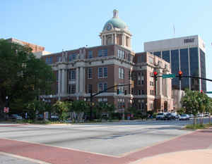
Chattahoochee County, also known as Cusseta-Chattahoochee County, is a county located in the state of Georgia. Based on the 2010 census,
the population was 11,267. The county
seat is Cusseta. The
county was created on February 13, 1854. The county is
named in honor of Chattahoochee River.
Chattahoochee County is included in the Columbus, GA-AL Metropolitan Statistical Area.
Etymology - Origin of Cusseta-Chattahoochee County County Name
The county is named for the Chattahoochee River that forms the county's western boundary.
Demographics:
County QuickFacts: CensusBureau Quick Facts
Cusseta-Chattahoochee County History
Chattahoochee County was formed in 1854 from parts of Marion and Muscogee counties. It was named for the Chattahoochee River that forms the county's western boundary.
The county seat is Cusseta, with which the county shares a
consolidated city-county government. Despite the city-county government
Cusseta is not coterminous with the county; it remains a geographically
distinct municipality within the county.
The city of Cusseta is named for one of the principal tribes of the Lower Creek Indians.
Points of Interest
The county is home to the Fort Benning Military Reservation, the county's largest employer. Fort Benning was founded at the beginning of the first World War, and was named for General Henry Lewis Benning, a Confederate general who hailed from Columbus. It is the world's largest infantry camp, and
is often called the "West Point of the South."
Two plants on Georgia's Protected Plant List can be found in the county: Croomia Pauci flora and Rhododendron Prunifolium.
Fort Benning and Cusseta boast eight sites located on the National Register of Historic Places, most relating to the establishment of the fort and to Native American culture. The National Infantry Museum, constructed in 1928 as a post hospital, houses a collection of weapons, uniforms, and artifacts
illustrating the role of the infantry in the nation's wars.
Geography: Land and Water
As reported by the Census Bureau, the county has a total area of 251 square miles (650 km2), of which 249 square miles (640 km2) is land and 2.4 square miles (6.2 km2) (1.0%) is water.
Chattahoochee county is located in west Georgia. The county is in the Flint River basin and the Chattahoochee River basin.
Neighboring Counties
Bordering counties are as follows:
- Northeast: Talbot County
- East: Marion County
- South: Stewart County
- West: Russell County, Ala.
- Northwest: Muscogee County
Education


Click Image to Enlarge
