


Click Image to Enlarge
Georgia Counties
Georgia is divided into one hundred and fifty-nine counties. The original eight counties of the State of Georgia were Burke, Camden, Chatham, Effingham, Glynn, Liberty, Richmond and Wilkes all created on February 5, 1777. The last new county to be established in Georgia was Peach County, established in 1924.Forsyth County, Georgia
Forsyth County Education, Geography, and History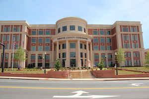
Forsyth County is a county located in the state of Georgia. Based on the 2010 census, the
population was 175,511. Forsyth County was
created on December 3, 1832 from Cherokee County. The
county seat is
Cumming. The county is named in honor of John Forsyth
(1780-1841), Secretary of State under President Martin Van Buren.
Forsyth County is included in the Atlanta-Sandy Springs-Roswell, GA Metropolitan Statistical Area.
Etymology - Origin of Forsyth County Name
The county is named for John Forsyth, Governor of Georgia from 1827-1829 and Secretary of State under Presidents Andrew Jackson and Martin Van Buren.
Demographics:
County QuickFacts: CensusBureau Quick Facts
Forsyth County History
Forsyth County was created in 1832 from parts of the original Cherokee Country. It was named for John Forsyth, Governor of Georgia from 1827-1829 and Secretary of State under Presidents Andrew Jackson and Martin Van Buren.
Cumming was established in 1834. The city is named for Colonel William Cumming of Augusta, a prominent lawyer.
Several Indian archaeological sites are located within Forsyth County. An Indian mound and village are located on Settendown Creek near the mouth of the Etowah River. Another Indian village is located near Sawnee Mountain on Big Creek.
Two places of historic note in Forsyth County are Pool's Mill Covered Bridge and the Settles Home. One of the few remaining covered bridges in the country, Pool's Mill is on the National Register of Historic Places. The Settles Home is considered to be the oldest home in the county and is under
consideration to be listed as a historic landmark.
Points of Interest
Much of the eastern side of the county lies on the shores of Lake Sidney Lanier, one of the busiest recreational bodies of water in the nation with 200 miles of shoreline. Created in the 1950s with the impoundment of the Chattahoochee River at Buford Dam, the lake has accelerated the growth of
the county, as well as provided recreational enjoyment for many throughout north Georgia. The lake is home to Southern Bald Eagles and Peregrine Falcons, both endangered species.
Forsyth County has been ranked by the US Census as the fastest growing county in Georgia.
Notable Citizens
Famous residents of Forsyth County include Hiram P. Bell, a Confederate Officer and US Congressman, and William Rogers, Johnson Rogers, and George Welch, signers of the Treaty of New Echota which established the terms of removal for the Cherokee Indians.
Geography: Land and Water
As reported by the Census Bureau, the county has a total area of 247 square miles (640 km2), of which 224 square miles (580 km2) is land and 23 square miles (60 km2) (9.4%) is water.
Forsyth county is located in north Georgia. The county is in the Coosa River basin and the Chattahoochee River basin.
Neighboring Counties
Bordering counties are as follows:
- North: Dawson County
- Northeast: Hall County
- Southeast: Gwinnett County
- Southwest: Fulton County
- West: Cherokee County
Education


Click Image to Enlarge
