


Click Image to Enlarge
Georgia Counties
Georgia is divided into one hundred and fifty-nine counties. The original eight counties of the State of Georgia were Burke, Camden, Chatham, Effingham, Glynn, Liberty, Richmond and Wilkes all created on February 5, 1777. The last new county to be established in Georgia was Peach County, established in 1924.Jeff Davis County, Georgia
Jeff Davis County Education, Geography, and History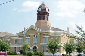
Jeff Davis County is a county located in the state of Georgia. Based on the 2010 census, the population was 15,068. The county was created on August 18, 1905. The county seat is Hazlehurst. Jeff Davis is named for Jefferson Davis, the only President of the Confederate States of America.
Etymology - Origin of Jeff Davis County Name
The county is named for Jefferson Davis, President of the Confederacy. Davis had served as the US Secretary of War prior to the Civil War.
Demographics:
County QuickFacts: CensusBureau Quick Facts
Jeff Davis County History
Jeff Davis County was created in 1905 from parts of Appling and Coffee counties. Georgia's 140th county was named for Jefferson Davis, President of the Confederacy. Davis had served as the US Secretary of War prior to the Civil War.
Hazlehurst was named for Colonel George Hazlehurst, a civil engineer who surveyed the Macon & Brunswick Railroad. In August of 1995, Hazlehurst celebrated its "Censilver," 150 years of existence.
Points of Interest
The Altamaha River is formed from the merger of the Oconee and Ocmulgee rivers just northwest of Jeff Davis County. This is the largest free-flowing stream in Georgia and a haven for sports enthusiasts. Some of the largest largemouth bass in Georgia are found in these rivers. At least ten fishing
tournaments are held in the county every year.
The tobacco crop was very important in the early history of Jeff Davis County, and the Hazlehurst Tobacco Market was one of Georgia's strongest.
Jeff Davis County shares the Bullard Creek Wildlife Management Area, totaling 16,000 acres, with Bacon County.
Geography: Land and Water
As reported by the Census Bureau, the county has a total area of 335 square miles (870 km2), of which 331 square miles (860 km2) is land and 4.7 square miles (12 km2) (1.4%) is water.
Jeff Davis county is located in southeast Georgia. The county is in the Altamaha River basin, the Ocmulgee River basin and the Satilla River basin
Neighboring Counties
Bordering counties are as follows:
- North: Wheeler County; Montgomery County
- Northeast: Toombs County
- East: Appling County
- Southeast: Bacon County
- Southwest: Coffee County
- Northwest: Telfair County
Education


Click Image to Enlarge
