


Click Image to Enlarge
Georgia Counties
Georgia is divided into one hundred and fifty-nine counties. The original eight counties of the State of Georgia were Burke, Camden, Chatham, Effingham, Glynn, Liberty, Richmond and Wilkes all created on February 5, 1777. The last new county to be established in Georgia was Peach County, established in 1924.Turner County, Georgia
Turner County Education, Geography, and History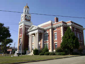
Turner County is a county located in the state of Georgia. Based on the 2010 census, the population was 8,930. The county was created on August 18, 1905. The county seat is Ashburn. Turner county is named for Henry Gray Turner, US representative and Georgia state Supreme Court justice.
Etymology - Origin of Turner County Name
Georgia's 143rd county was named after Henry Gray Turner, a captain in the Confederate Army who was captured at Gettysburg and later served in the state legislature, on the State Supreme Court, and in the US Congress.
Demographics:
County QuickFacts: CensusBureau Quick Facts
Turner County History
Turner County was created in 1905 from parts of Dooly, Irwin, Wilcox and Worth counties. Georgia's 143rd county was named after Henry Gray Turner, a captain in the Confederate Army who was captured at Gettysburg and later served in the state legislature, on the State Supreme Court, and in the
US Congress.
Rebecca was named for the daughter of a prominent local family, while Sycamore was named for the tree. Ashburn was named for W.W. Ashburn who, in 1890, purchased a portion of the future town site for ten dollars.
Until the 1920s, when the boll weevil struck, Turner County farmers planted over 30,000 acres of cotton. Unable to continue growing cotton, Turner County instituted Georgia's first "cow-hog-hen" programs, beginning an age of diversified farming that spread throughout the state.
Points of Interest
Shingler Heights, five blocks of residential buildings and one institutional building in Ashburn, was constructed from 1895 to 1937. The district is listed on the National Register of Historic Places. Its most elaborate structure is "Sparrow's Nest," built by a local turpentine and agriculture
entrepreneur, J.S. Shingler. Many of the homes in the historic district were built by Shingler's relatives.
Other entries on the National Register are the Ashburn Heights-Hudson College Avenue area and the Ashburn Commercial Business District.
Turner County is home to several endangered species on the Federal Protected list including the Florida Panther, the Indigo Snake, and the Southern Bald Eagle.
Geography: Land and Water
As reported by the Census Bureau, the county has a total area of 290 square miles (750 km2), of which 285 square miles (740 km2) is land and 4.6 square miles (12 km2) (1.6%) is water.
Turner county is located close to the center of Georgia. The county is largely in the Suwannee River basin with a small part of western Turner in the Flint River basin.
Neighboring Counties
Bordering counties are as follows:
- Northeast: Wilcox County
- East: Ben Hill County
- Southeast: Irwin County; Tift County
- Southwest: Worth County
- Northwest: Crisp County
Education


Click Image to Enlarge
