


Click Image to Enlarge
Idaho Counties
There are forty-four Counties in Idaho. When Idaho became a territory in March, 1863, there were four Counties in existence: Boise, Idaho, Nez Perce and Shoshone. By the time Idaho became a state, there were 15 counties. The rest of the 44 Counties came into existence during the 30 years after Idaho became a state. Two of the former counties disappeared during this time. Alturas, which was created in 1864, was later divided into the many counties now found in central Idaho. Logan County was only in existence for six years, from 1889 to 1895. It was combined with Alturas to form Blaine County and Lincoln County, which was formed just two weeks after Logan lost its identity.Canyon County, Idaho
Canyon County Education, Geography, and History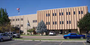
Canyon County is a county located in the state of Idaho. Based on the 2010 census, the
population was 188,923 making it the second-most
populous county in Idaho. Canyon County was created on
March 7, 1891. The county seat is Caldwell, and its largest city is Nampa.
The county name is disputed, either a canyon of the
Boise River near Caldwell or a canyon of the Snake River which forms
part of the county's boundary.
Canyon County is part of the Boise, ID Metropolitan Statistical Area.
Etymology - Origin of Canyon County Name
Canyon County is named for a canyon in the area. Sources disagree whether the canyon is on the Boise River or the Snake River.
Demographics:
County QuickFacts: CensusBureau Quick Facts
Canyon County History
Established March 7, 1891 with its county seat at Caldwell. Current sources attribute the name to the canyon of the Boise River near Caldwell. However, both John Rees and Vardis Fisher believed it was named for the Snake River canyon which forms a natural boundary for the county. The Hudson's Bay Company established Fort Boise in 1834 near what is now Parma, but abandoned it in 1855. Immigrants traveled through Canyon County on the Oregon Trail.
Geography: Land and Water
As reported by the Census Bureau, the county has a total area of 604 square miles (1,560 km2), of which 587 square miles (1,520 km2) is land and 16 square miles (41 km2) (2.7%) is water.
Canyon county is located in west Idaho. Parts of Deer Flat National Wildlife Refuge and Snake River Birds of Prey National Conservation Area are found in this county.
Neighboring Counties
Bordering counties are as follows:
- North: Payette County
- Northeast: Gem County
- Southeast: Ada County; Owyhee County
- Southwest: Malheur County, Ore.
Education


Click Image to Enlarge
