


Click Image to Enlarge
Idaho Counties
There are forty-four Counties in Idaho. When Idaho became a territory in March, 1863, there were four Counties in existence: Boise, Idaho, Nez Perce and Shoshone. By the time Idaho became a state, there were 15 counties. The rest of the 44 Counties came into existence during the 30 years after Idaho became a state. Two of the former counties disappeared during this time. Alturas, which was created in 1864, was later divided into the many counties now found in central Idaho. Logan County was only in existence for six years, from 1889 to 1895. It was combined with Alturas to form Blaine County and Lincoln County, which was formed just two weeks after Logan lost its identity.Custer County, Idaho
Custer County Education, Geography, and History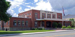
Custer County is a rural mountain county located in the center of the state of Idaho. Based on the 2010 census, the population was 4,368. Custer County was created on January 8, 1881. The county seat is Challis. Custer county is named for the General Custer Mine, where gold was discovered five years earlier.
Etymology - Origin of Custer County Name
Custer County is named for the General Custer mine, in turn named after General George Armstrong Custer.
Demographics:
County QuickFacts: CensusBureau Quick Facts
Custer County History
Established January 8, 1881 with its county seat at Challis. Named for the General Custer mine, which was named in honor of General George Custer who died at the Battle of Little Bighorn. Its history begins with fur traders and pathfinders as early as 1824; later in the 1860s and 1870s prospectors and miners came. It contains portions of the Sawtooth, Salmon River, White Cloud, Pioneer, Lost River, and White Knob Mountains and contains the highest peaks in the state.
Geography: Land and Water
As reported by the Census Bureau, the county has a total area of 4,937 square miles (12,790 km2), of which 4,721 square miles (12,230
km2) is land and 16 square miles (41 km2) (0.3%) is water. It is the third-largest county in Idaho by area.
Custer county is located close to the center of Idaho.
The Lost River Range, the state's highest mountains, are located in eastern Custer County. The highest is Borah Peak, the highest natural
point in Idaho at 12,662 feet (3,859 m). On the western border of the county is Idaho's famous Sawtooth Range; the tallest is Thompson Peak in
Custer County, above picturesque Redfish Lake. Twenty miles (32 km) east are the White Cloud Mountains, the tallest of which is Castle Peak at
11,815 feet (3,601 m).
The Salmon River and Big Lost River flow through Custer County.
Neighboring Counties
Bordering counties are as follows:
- Northeast: Lemhi County
- Southeast: Butte County; Blaine County
- Southwest: Elmore County
- West: Boise County
- Northwest: Valley County
Education


Click Image to Enlarge
