


Click Image to Enlarge
Idaho Counties
There are forty-four Counties in Idaho. When Idaho became a territory in March, 1863, there were four Counties in existence: Boise, Idaho, Nez Perce and Shoshone. By the time Idaho became a state, there were 15 counties. The rest of the 44 Counties came into existence during the 30 years after Idaho became a state. Two of the former counties disappeared during this time. Alturas, which was created in 1864, was later divided into the many counties now found in central Idaho. Logan County was only in existence for six years, from 1889 to 1895. It was combined with Alturas to form Blaine County and Lincoln County, which was formed just two weeks after Logan lost its identity.Elmore County, Idaho
Elmore County Education, Geography, and History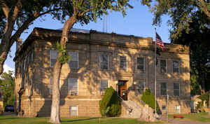
Elmore County is a county located in the state of Idaho. Based on the 2010 census, the
population was 29,130. Elmore County was
created on February 7, 1889. The county
seat is Mountain Home. The county is named
for the Ida Elmore mines, locally noted for gold and silver production
in the 1860s.
Elmore County comprises the Mountain Home, ID Micropolitan Statistical Area, which is also included in the Boise-Mountain Home-Ontario, ID-OR
Combined Statistical Area.
Etymology - Origin of Elmore County Name
Elmore County is named for the Ida Elmore mines.
Demographics:
County QuickFacts: CensusBureau Quick Facts
Elmore County History
Established February 7, 1889 with its county seat at Rocky Bar. Named for the Ida Elmore mines, the area's greatest silver and gold producer of the 1860s. The Oregon Trail crossed the Snake River at Three Island Crossing near Glenns Ferry. A station on the overland stage route, originally named Rattlesnake, was moved to the railroad line and became Mountain Home. On February 4, 1891 the county seat was moved to Mountain Home.
Geography: Land and Water
As reported by the Census Bureau, the county has a total area of 3,101 square miles (8,030 km2), of which 3,075 square miles (7,960 km2) is land and 26 square miles (67 km2) (0.8%) is water.
Elmore county is located close to the center of Idaho. The highest point is Snowyside Peak at 10,651 feet (3,246 m) above sea level, located in the northeast corner of the county in the Sawtooth Wilderness. The lowest elevation in the county is the Snake River in the southwest corner, at less than 2,500 feet (760 m).
Neighboring Counties
Bordering counties are as follows:
- Northeast: Custer County; Camas County
- East: Blaine County
- Southeast: Gooding County; Twin Falls County
- Southwest: Owyhee County
- West: Ada County
- Northwest: Boise County
Education


Click Image to Enlarge
