


Click Image to Enlarge
Idaho Counties
There are forty-four Counties in Idaho. When Idaho became a territory in March, 1863, there were four Counties in existence: Boise, Idaho, Nez Perce and Shoshone. By the time Idaho became a state, there were 15 counties. The rest of the 44 Counties came into existence during the 30 years after Idaho became a state. Two of the former counties disappeared during this time. Alturas, which was created in 1864, was later divided into the many counties now found in central Idaho. Logan County was only in existence for six years, from 1889 to 1895. It was combined with Alturas to form Blaine County and Lincoln County, which was formed just two weeks after Logan lost its identity.Franklin County, Idaho
Franklin County Education, Geography, and History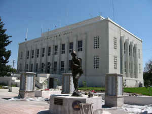
Franklin County is a county located in the state of Idaho. Based on the 2010 census, the county had a
population of 12,786. The county was created in 1913. The
county seat and largest city is
Preston. Franklin county is named after Franklin D.
Richards, an Apostle of The Church of Jesus Christ of Latter-day Saints.
Franklin County is part of the Logan, UT-ID Metropolitan Statistical Area.
The Bear River Massacre took place in present-day Franklin County on January 29, 1863.
Etymology - Origin of Franklin County Name
Franklin County is named for Franklin, the first permanent town in the state, in turn named for Franklin Richards, an apostle of The Church of Jesus Christ of Latter-day Saints.
Demographics:
County QuickFacts: CensusBureau Quick Facts
Franklin County History
Established January 20, 1913 with its county seat at Preston. Named for the first settlement in Idaho, Franklin, which in turn was named for Franklin Richards, an apostle of the Mormon Church. The settlement began in Franklin county in 1860 with thirteen families. The county is the only Franklin County in the United States that is not named after Benjamin Franklin.
Geography: Land and Water
As reported by the Census Bureau, the county has a total area of 668 square miles (1,730 km2), of which 664 square miles (1,720 km2) is land and 4.7 square miles (12 km2) (0.7%) is water.
Franklin county is located in southeast Idaho. Part of the Cache National Forest and Caribou National Forest are located in this county.
Neighboring Counties
Bordering counties are as follows:
- Northeast: Caribou County; Bear Lake County
- Southeast: Rich County, Utah
- South: Cache County, Utah
- Southwest: Box Elder County, Utah
- West: Oneida County
- Northwest: Bannock County
Education


Click Image to Enlarge
