


Click Image to Enlarge
Idaho Counties
There are forty-four Counties in Idaho. When Idaho became a territory in March, 1863, there were four Counties in existence: Boise, Idaho, Nez Perce and Shoshone. By the time Idaho became a state, there were 15 counties. The rest of the 44 Counties came into existence during the 30 years after Idaho became a state. Two of the former counties disappeared during this time. Alturas, which was created in 1864, was later divided into the many counties now found in central Idaho. Logan County was only in existence for six years, from 1889 to 1895. It was combined with Alturas to form Blaine County and Lincoln County, which was formed just two weeks after Logan lost its identity.Teton County, Idaho
Teton County Education, Geography, and History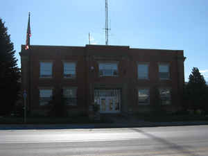
Teton County is a county located in the state of Idaho. Based on the 2010 census, the
population was 10,170. The county was created in 1915. The
county seat is Driggs, and the largest
city is Victor. Teton county is named after the Teton Mountains to the east.
Teton County is part of the Jackson, WY-ID Micropolitan Statistical Area.
The Teton Valley was discovered by John Colter in 1808, a member of the Lewis and Clark Expedition (1804-06). It became known as Pierre's
Hole, and it hosted the well-attended 1832 Rendezvous, which was followed by the Battle of Pierre's Hole.
Etymology - Origin of Teton County Name
Teton County is named for the Teton Range.
Demographics:
County QuickFacts: CensusBureau Quick Facts
Teton County History
Established January 26, 1915, with its county seat at Driggs. It was named for the adjacent Teton mountains and valley. The valley was formerly known as Pierre's Hole where Indians held their councils and trappers met for their rendezvous.
Geography: Land and Water
As reported by the Census Bureau, the county has a total area of 451 square miles (1,170 km2), of which 449 square miles (1,160 km2) is land and 1.1 square miles (2.8 km2) (0.2%) is water.
Teton county is located in east Idaho. The county is the second-smallest county in Idaho by area.
Neighboring Counties
Bordering counties are as follows:
- North: Fremont County
- East: Teton County, Wyo.
- South: Bonneville County
- West: Madison County
Education
The public schools are operated by Teton School District #401, led by the county's only traditional high school, Teton High School, in Driggs.


Click Image to Enlarge
