


Click Image to Enlarge
Idaho Counties
There are forty-four Counties in Idaho. When Idaho became a territory in March, 1863, there were four Counties in existence: Boise, Idaho, Nez Perce and Shoshone. By the time Idaho became a state, there were 15 counties. The rest of the 44 Counties came into existence during the 30 years after Idaho became a state. Two of the former counties disappeared during this time. Alturas, which was created in 1864, was later divided into the many counties now found in central Idaho. Logan County was only in existence for six years, from 1889 to 1895. It was combined with Alturas to form Blaine County and Lincoln County, which was formed just two weeks after Logan lost its identity.Washington County, Idaho
Washington County Education, Geography, and History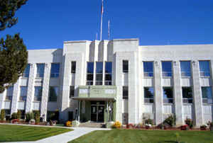
Washington County is a county in the state of Idaho. Based on the 2010 census, the population was 10,198. The county was created in 1879. The county seat and largest city is Weiser, with over half of the county's population. Washington county is named after US president George Washington.
Etymology - Origin of Washington County Name
Washington County is named for George Washington (1732-1799), President of the United States from 1789 to 1797.
Demographics:
County QuickFacts: CensusBureau Quick Facts
Washington County History
Established February 20, 1879, with Weiser as its county seat. Named for George Washington, the first president of the United States. Donald MacKenzie was one of the first white men in the area in 1811. Settlers came in the 1860s after gold was discovered in the area.
Geography: Land and Water
As reported by the Census Bureau, the county has a total area of 1,474 square miles (3,820 km2), of which 1,453 square miles (3,760 km2) is land and 21 square miles (54 km2) (1.4%) is water.
Washington county is located close to the center of Idaho. Parts of Boise National Forest, Deer Flat National Wildlife Refuge, and Payette National Forest are located in this county.
Neighboring Counties
Bordering counties are as follows:
- Northeast: Adams County
- Southeast: Gem County
- South: Payette County
- Southwest: Malheur County, Ore.
- Northwest: Baker County, Ore.
Education


Click Image to Enlarge
