


Click Image to Enlarge
Illinois Counties
There are one hundred and two counties in Illinois. St. Clair County was the first county established in what is today Illinois. Most counties in Illinois were named after early American leaders, especially of the American Revolutionary War, as well as soldiers from the Battle of Tippecanoe and the War of 1812.Calhoun County, Illinois
Calhoun County Education, Geography, and History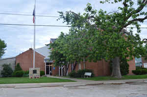
Calhoun County is a county located in the state of Illinois. Based on the 2010 census, the
population was 5,089, making it the
third-least populous county in Illinois. Calhoun County was
created on January 10, 1825. The county
seat is Hardin. This county is named
for John C. Calhoun (1782-1850), South Carolina senator and seventh Vice
President of the United States.
Calhoun County is part of the Metro-East portion of the St. Louis, MO-IL Metropolitan Statistical Area.
Etymology - Origin of Calhoun County Name
The county is named for John C. Calhoun, southern statesman and US Vice President under Presidents Adams and Jackson.
Demographics:
County QuickFacts: CensusBureau Quick Facts
Calhoun County History
Calhoun County was created on January 10, 1825 (Laws, 1825, p. 65) and was formed from Pike County. Present area, or
parts of it, formerly included in: Pike County (1821-1825), Madison County (1812-1821) and St. Clair County (1795-1812).
The County was named for John C. Calhoun, a lawyer and statesman, Representative in Congress and United States Senator
from South Carolina, Secretary of War under Monroe, Vice-President of the United States, and Secretary of State under
Tyler, and was recognized as the "Father of Nullification."
The County Seat is Hardin. Prior County Seats was Gilead (1825-1847), Hamburg- Temporary selection (1847) and Hardin
(1847-Present).
Calhoun County, like Jo Daviess County in northwest Illinois, is unique in the state in that glaciers didn't
touch it and therefore has a more rugged terrain that is dissected by valleys than the generally flat terrain
associated with the rest of Illinois. Calhoun County is also located at the tip of the peninsula formed by the
Mississippi and Illinois Rivers and is almost completely surrounded by water. Often referred to as the 'Kingdom',
Calhoun County is sparsely populated with only 5 incorporated towns.
Human habitation of Calhoun County dates back as far as the Early Archaic era (6400 - 3900 B.C.E.) and many have
termed the area the "Nile of North America." Kampsville is centered in the heart of this remarkable archeological
region and the archeologists and students of the Center for American Archeology spend their summers conducting digs
and fieldwork. There are also many mounds dating from the Middle Woodland era (800 - 1200 A.D.) that have been
located in different parts of the county. When the French explorers Louis Joliet and Jacques Marquette passed by
Calhoun County in 1673 the Illini Confederation occupied the territory. The Illini were a woodland people who
alternated between farming and hunting depending on the season and located their villages in river valleys to take
advantage of the soil conditions. The power of the Illini was on the wane in the late 17th century due to pressure
from surrounding tribes particularly by the Iroquois from the east. There are historical accounts of a massacre near
the present day site of the Brussels Free Ferry in 1680 and over the last 75 years farmers plowing their fields in
this area have found skulls, skeletons, and weapons.
The first permanent European settler was a French trapper named O'Neal who settled in Point Precinct (the southern
tip of Calhoun County) in 1801 and lived in a cave until his death in 1842. O'Neal was followed by other French
trappers who started a colony above the Brussels Free Ferry but were driven out by floods in 1815. After the war of
1812 the government set aside the lands between the Mississippi and Illinois Rivers for veterans and a rush of
settlers began around 1823. However most of the land settled in Calhoun County was not by veterans, most of who sold
their land to speculators, but by settlers who learned about the region. In 1821 Pike County was organized and
included all the territory between the Mississippi and Illinois Rivers up to the Wisconsin border and east to Lake
Michigan. In 1825 the southern part of Pike County was cut off and made into a separate county. The new county was
named after John C. Calhoun, a lawyer, politician, and statesman, from South Carolina and Gilead was selected as the
county seat. In 1847 the county seat was moved to Child's Landing, now known as Hardin.
Geography: Land and Water
As reported by the Census Bureau, the county has a total area of 284 square miles (171680 Acres) (735 km2), of
which 254 square miles (657 km2) is land and 30 square miles (77 km2) (10.53%) is water.
Calhoun county is located in southwest Illinois.
Calhoun County is a narrow finger of mostly high ground located between the Mississippi River and the Illinois
River. Calhoun County is located at the tip of the peninsula formed by
the confluence of the Mississippi and Illinois rivers and is almost
completely surrounded by water. Often referred to as "The Island,"
Calhoun County is sparsely populated; it has seven or eight
municipalities, all villages. Part of Two Rivers National Wildlife
Refuge is located in this county.
Neighboring Counties
Bordering counties are as follows:
- Northeast: Greene County
- Southeast: Jersey County
- South: St. Charles County, Mo.
- Southwest: Lincoln County, Mo.
- Northwest: Pike County, Mo.; Pike County
Education
- Brussels Community Unit School District 42
- Calhoun Community Unit School District 40


Click Image to Enlarge
