Illinois Counties
There are one hundred and two counties in Illinois. St. Clair County was the first county established in what is today Illinois. Most counties in Illinois were named after early American leaders, especially of the American Revolutionary War, as well as soldiers from the Battle of Tippecanoe and the War of 1812.DuPage County, Illinois
DuPage County Education, Geography, and History
DuPage County is a county located in the state of Illinois. Based on the 2010 census, the
population was 916,924, making it the
second-most populous county in Illinois. DuPage County was
created on February 9, 1839. The county
seat is Wheaton. The county is named
for the DuPage River.
Dupage County is one of the collar counties of the Chicago-Naperville-Elgin, IL-IN-WI Metropolitan Statistical Area.
Etymology - Origin of DuPage County Name
The County was named for a small river named DuPage which flows through the county and is said to have derived its name from a French trapper and trader of that region.
Demographics:
County QuickFacts: CensusBureau Quick Facts
DuPage County History
DuPage County was created on February 9, 1839 (Laws, 1839, p. 73) and was formed from Cook County. Present area, or
parts of it, formerly included in: Cook County (1831-1839), Putnam County (1825-1831), Fulton County (1823-1825), Pike
County (1821-1823), Clark County (1819-1821), Crawford County (1816-1819), Edwards County (1815-1816), Madison County
(1812-1815), St. Clair County (1801-1812) and Knox, Northwest Territory (1790-1801).
The County was named for a small river named DuPage which flows through the county and is said to have derived its name
from a French trapper and trader of that region. The County Seat is Wheaton . Prior County Seats was Naperville
(1839-1867) and Wheaton (1867-Present).
Geography: Land and Water
As reported by the Census Bureau, the county has a total area of 337 sq mi (873 km2), of which, 334 sq mi (865 km2) of it is land and 3 sq mi (7.8 km2) of it is water.
Dupage county is located in northeast Illinois. The DuPage River and the Salt Creek flow through
this county. According to the Forest Preserve District of DuPage County, the highest point in the county is located at
the Mallard Lake Landfill, which is at its highest point 982 feet (299 m) above mean sea level.
Part of James "Pate" Philip State Park is located in this county.
Neighboring Counties
Bordering counties are as follows:
- East: Cook County
- South: Will County
- Southwest: Kendall County
- Northwest: Kane County
Education
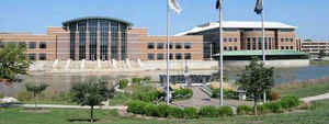
The College of DuPage, in Glen Ellyn, is one of the largest community colleges in the United States. Wheaton College is one of the most
well-known and respected evangelical Christian colleges in the country. Benedictine University, Elmhurst College and North Central College
also have long and respected histories in their communities.
Other prominent colleges and universities include: Midwestern University in Downers Grove; National University of Health Sciences and Northern
Baptist Theological Seminary in Lombard; the Addison, Naperville and Oak Brook campuses of DeVry University; the Aurora campus of Robert
Morris University; the Lisle campus of National-Louis University; the Naperville campuses of DePaul University and Northern Illinois
University; the Wheaton campus of Illinois Institute of Technology; and the DuPage campus of Westwood College in Woodridge. Hamburger
University, McDonald's global training facility, is located at its corporate headquarters in Oak Brook, on an 80-acre (32 ha) campus.


