


Click Image to Enlarge
Illinois Counties
There are one hundred and two counties in Illinois. St. Clair County was the first county established in what is today Illinois. Most counties in Illinois were named after early American leaders, especially of the American Revolutionary War, as well as soldiers from the Battle of Tippecanoe and the War of 1812.McLean County, Illinois
McLean County Education, Geography, and History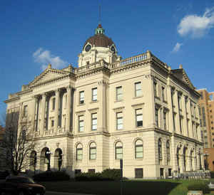
McLean County is the largest county by land area in the state of Illinois. According to the 2010 census, it had a
population of
169,572. McLean County was created on December
25, 1830. The county seat is Bloomington.
The county is named for John McLean (1791-1830), United
States Representative and United States Senator from Illinois.
McLean County is included in the Bloomington, IL Metropolitan Statistical Area.
Etymology - Origin of McLean County Name
The county is named for John McLean, first representative in Congress from Illinois in 1818 and United States Senator (1824-1825).
Demographics:
County QuickFacts: CensusBureau Quick Facts
McLean County History
McLean County was created on December 25, 1830 (Laws, 1830, p. 31) and was formed from Tazewell and unorganized land
(Tazewell County). Present area, or parts of it, formerly included in: Eastern Part [Shelby County (1827-1830), Fayette
County (1821-1827), Clark County (1819-1821), Crawford County (1816-1819), Edwards County (1815-1816)], Western Part
[Tazewell County (1827-1831), Peoria County (1825-1827), Sangamon County (1821-1825), Bond County (1817-1821)], Madison
County (1812-1817), St. Clair County (1801-1812) and Knox, Northwest Territory (1790-1801).
The County was named for John McLean, a pioneer lawyer, Territorial judge, first Representative in Congress from
Illinois (1818), and United States Senator (1824-1825). The County Seat is Bloomington (1831-Present, Named Blooming
Grove until 1831).
Geography: Land and Water
According to the U.S. Census Bureau, the county has a total area of 1,186 square miles (3,070 km2), of which 1,183 square miles (3,060 km2) is land and 2.9 square miles (7.5 km2) (0.2%) is water.
McLean county is located close to the center of Illinois. The county is the largest county in Illinois by land area and third-largest by total area. Moraine View State Recreation Area is located in this county. McLean County boasts some of the richest soil in the world. Only patches of farmland in Argentina, southern Ukraine and along the Yellow River in China match the fertile ground that covers much of the northern half of Illinois, particularly a high-yielding band through the state's midsection.
Neighboring Counties
Bordering counties are as follows:
- Northeast: Livingston County
- East: Ford County
- Southeast: Champaign County; Piatt County
- South: DeWitt County
- Southwest: Logan County
- West: Tazewell County
- Northwest: Woodford County
Education


Click Image to Enlarge
