


Click Image to Enlarge
Illinois Counties
There are one hundred and two counties in Illinois. St. Clair County was the first county established in what is today Illinois. Most counties in Illinois were named after early American leaders, especially of the American Revolutionary War, as well as soldiers from the Battle of Tippecanoe and the War of 1812.Wayne County, Illinois
Wayne County Education, Geography, and History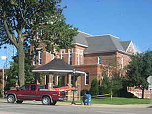
Wayne County is a county located in the state of Illinois. According to the 2010 census, it had a population of 16,760. Wayne County was created on March 26, 1819. The county seat is Fairfield. The county is named for General "Mad" Anthony Wayne (1745-1796), major general in the United States Army in the American Revolutionary War and the Northwest Indian War.
Etymology - Origin of Wayne County Name
The county is named for General Anthony Wayne, famed revolutionary commander and Indian fighter.
Demographics:
County QuickFacts: CensusBureau Quick Facts
WayneCounty History
Warren County was created on January 13, 1825 (Laws, 1825, p. 93) and was formed from unorganized land (Pike County). County organization was completed in July, 1830. Present area, or parts of it, formerly included in: Attached to Peoria County [Laws, 1826, p. 76-77] (1826-1830), Attached to Schuyler County [Laws, 1825, p. 95] (1825-1826), Pike County (1812-1825), Madison County (1812-1821) and St. Clair County (1795-1812).
The County was named for Joseph Warren, a physician and soldier who served at Lexington, a Major General of the Massachusetts militia. He was killed at the
battle of Bunker Hill. The county
seat is Fairfield. It is located in the southern portion of Illinois known locally as "Little Egypt". Prior County Seats was House of Alexis Phelps, at Lower Yellow Banks, now Oquawka- Temporary designation
(1830-1831) and Monmouth (1831-Present).
Geography: Land and Water
As reported by the Census Bureau, the county has a total area of 716 square miles (1,853 km2), of which, 714 square miles (1,849 km2) of it is land and 2 square miles (4 km2) of it (0.23%) is water.
Wayne county is located in south Illinois. Sam Dale Lake State Fish
and Wildlife Area is located in this county.
Neighboring Counties
Bordering counties are as follows:
- North: Clay County
- Northeast: Richland County
- East: Edwards County
- Southeast: White County
- Southwest: Hamilton County; Jefferson County
- Northwest: Marion County
Education


Click Image to Enlarge
