


Click Image to Enlarge
Indiana Counties
Indiana is divided into ninety-two counties. The oldest and newest Counties in Indiana are Knox County (created 1790) and Newton County (created 1857).Many Indiana counties are named for the US Founding Fathers and personalities of the American Revolutionary War, the War of 1812 and Battle of Tippecanoe; early leaders of Indiana Territory and Indiana, as well as surrounding states like Michigan and Kentucky; plus Native American tribes and geographical features.Harrison County, Indiana
Harrison County Education, Geography, and History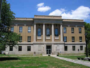
Harrison County is located in the far southern part of the state of Indiana along the Ohio River. Based on the 2010 census, the county's population was 39,364, an increase of 6.6% from 2000. Harrison County was created on December 1, 1808. The county seat is Corydon. The county is named for William Henry Harrison, governor of Indiana Territory and United States President.
Harrison County is part of the Louisville-Jefferson County, KY-IN Metropolitan Statistical Area.
Etymology - Origin of Harrison County Name
The county is named for General William Henry Harrison, First Territorial Governor of Indiana who later became the 9th President of the United States.
Demographics:
County QuickFacts: CensusBureau Quick Facts
Harrison County History
Harrison County was established December 1, 1808, and was the fourth county organized in Indiana having been taken from Knox and Clark counties. Harrison County has a long and interesting history dating back to the late 1770s when the area was captured by George Rogers Clark and added to the territory of the United States during the American Revolutionary War.
Harrison County is divided into 12 Civil Townships as follows: Blue River, Boone, Franklin, Harrison, Heth, Jackson, Morgan, Posey, Spencer, Taylor, Washington and Webster. Scott Township is now included in Harrison Township.
Geography: Land and Water
As reported by the 2010 census, the county has a total area of 486.52 square miles (1,260.1 km2), of which 484.52 square miles (1,254.9 km2) (or 99.59%) is land and 2.00 square miles (5.2 km2) (or 0.41%) is water.
Harrison county is located in south Indiana. Harrison County's surface is covered by many hills and valleys. The Ohio River borders the entire southeastern, southern, and southwestern part of the county. Blue River forms the western border.
Neighboring Counties
Bordering counties are as follows:
- North: Washington County
- Northeast: Floyd County
- East: Jefferson County, Ky.
- South: Hardin County, Ky.
- Southwest: Meade County, Ky.
- Northwest: Crawford County
Education
The county has 22 schools; 15 are public schools in 3 school districts, and 7 are private


Click Image to Enlarge
