


Click Image to Enlarge
Indiana Counties
Indiana is divided into ninety-two counties. The oldest and newest Counties in Indiana are Knox County (created 1790) and Newton County (created 1857).Many Indiana counties are named for the US Founding Fathers and personalities of the American Revolutionary War, the War of 1812 and Battle of Tippecanoe; early leaders of Indiana Territory and Indiana, as well as surrounding states like Michigan and Kentucky; plus Native American tribes and geographical features.Jasper County, Indiana
Jasper County Education, Geography, and History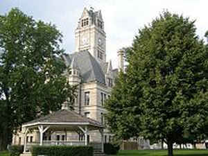
Jasper County is a county located in the state of Indiana. As of 2010, the
population was 33,478. Jasper County was
created on March 15, 1838. The county seat is Rensselaer.
The county is named for Sergeant William Jasper, hero
of the American Revolutionary War.
Jasper County is included in the Chicago-Naperville-Elgin, IL-IN-WI Metropolitan Statistical Area.
Etymology - Origin of Jasper County Name
The county is named for Revolutionary War hero Sergeant William Jasper killed at Savannah.
Demographics:
County QuickFacts: CensusBureau Quick Facts
Jasper County History
Jasper County was organized formally on March 15, 1838. Originally, the territory of Jasper included all of the present county of Newton and most of Benton. Before this time, it was attached to White County. It was named for Sgt. William Jasper, a famous scout for the Continental Army during the Revolutionary War. Jasper became famous in 1776, during the bombardment of Fort Moultrie, for erecting a new flagstaff under fire after the American flag had been shot down. Jasper was killed during the Siege of Savannah in 1779
Jasper County is divided into 13 Civil Townships as follows: Barkley, Carpenter, Gillam, Hanging Grove, Jordan, Kankakee, Keener, Marion, Milroy, Newton, Union, Walker and Wheatfield.
Geography: Land and Water
As reported by the Census Bureau, the county has a total area of 561 square miles (1,454 km2), of which 560 square miles (1,450 km2) is land and 1 square mile (4 km2) (0.24%) is water.
Jasper county is located in northwest Indiana. The county was drained to make farmland the middle of the 19th century. Jasper county is part of the 2nd largest freshwater wetland in the United States with abundant flora and fauna. The Iroquois River is one of the main branches of the Kankakee River and flows through Jasper County.
Neighboring Counties
Bordering counties are as follows:
- North: Porter County
- Northeast: Starke County
- East: Pulaski County
- Southeast: White County
- Southwest: Benton County; Newton County
- Northwest: Lake County
Education


Click Image to Enlarge
