


Click Image to Enlarge
Kansas Counties
Kansas has one hundred and five counties. Originally 33 counties were organized by the Territorial Legislature in 1855. The Chase County Courthouse in Cottonwood Falls, Kansas was built in 1873 and is the oldest operating courthouse in Kansas. As of January 1, 2009 Greeley County and the city of Tribune unified to form the Unified Government of Greeley County..Barber County, Kansas
Barber County Education, Geography, and History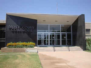
Barber County is a county located in the south-central portion of the state of Kansas. Based on the 2010 census, the county population was 4,861. Barber County was created on February 26, 1867. The county seat and most populous city is Medicine Lodge. Barber county is named for Thomas Barber, an abolitionist who was killed in Douglas County in 1855 during the Wakarusa War.
Etymology - Origin of Barber County Name
Barber county is named in honor of Thomas W. Barber, a Free State settler of Douglas County, who was killed in consequence of the political troubles, near Lawrence, December 6, 1855. (the county was originally named in the statute as "Barbour," but was corrected by special act of the Legislature in 1883.)
Demographics:
County QuickFacts: CensusBureau Quick Facts
Barber County History
Barber County, one of the southern tier, is bounded on the north by Pratt county, east by Kingman and Harper counties, south by the State of Oklahoma and west by Kiowa county. It was organized in 1873, from territory that was originally embraced in Washington county. The county was named for Thomas W. Barber, who was killed near Lawrence on Dec. 6, 1855. It was intended when the county was organized that it should bear the name "Barber," but in some manner the spelling was changed to "Barbour" and stood that way until 1883, when the legislature passed an act changing the name to "Barber," its present form, according to original intention. Its area is 1,134 square miles and, according to the Kansas Agricultural reports of 1908, it then ranked 73d in population.
Geography: Land and Water
As reported by the Census Bureau, the county has a total area of 1,136 square miles (2,940 km2), of which 1,134 square miles (2,940 km2) is land and 2.1 square miles (5.4 km2) (0.2%) is water.
Barber county is located in south Kansas. The eastern part of the county is rolling prairie and in some places nearly level, while the western portion is hilly and bluffs along the streams. The river bottoms in the east vary from one and a half to two miles in width, but in the western part are narrower and deeper. The native trees are walnut, elm, cottonwood, hackberry, ash, mulberry, cedar and willow. Barber county is exceptionally well watered. All the streams have a general southeast course. Medicine Lodge river, the largest stream, flows diagonally across the county from northwest to southeast. Little and Big Mule, Big Sandy and Salt Fork creeks in the south, and Elm creek in the north are also important streams. Springs are abundant throughout the county, while good well water is reached at from 10 to 12 feet on the lowlands.
Neighboring Counties
Bordering counties are as follows:
- North: Pratt County
- Northeast: Kingman County
- East: Harper County
- Southeast: Alfalfa County, Okla.
- Southwest: Woods County, Okla.
- West: Comanche County
- Northwest: Kiowa County
Education
Unified School Districts
Barber County North USD 254
South Barber County USD 255


Click Image to Enlarge
