


Click Image to Enlarge
Kansas Counties
Kansas has one hundred and five counties. Originally 33 counties were organized by the Territorial Legislature in 1855. The Chase County Courthouse in Cottonwood Falls, Kansas was built in 1873 and is the oldest operating courthouse in Kansas. As of January 1, 2009 Greeley County and the city of Tribune unified to form the Unified Government of Greeley County..Cheyenne County, Kansas
Cheyenne County Education, Geography, and History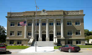
Cheyenne County is a county located in the northwest portion of the state of Kansas. Based on the 2010 census, the county population was 2,726. Cheyenne County was created on March 20, 1873. The county seat and most populous city is St. Francis. The county is named in honor of the Cheyenne Indian tribe, buffalo-hunters who roamed the plains of western Kansas and Nebraska south to the Arkansas River.
Etymology - Origin of Cheyenne County Name
The county is named in honor of the Cheyenne Indian tribe, buffalo-hunters who roamed the plains of western Kansas and Nebraska south to the Arkansas River.
Demographics:
County QuickFacts: CensusBureau Quick Facts
Cheyenne County History
Cheyenne County.- On March 6, 1873, Gov. Osborn approved an act creating a number of new counties out of the unorganized territory in the western part of the state. One of these counties was Cheyenne, the most northwestern county of Kansas, the boundaries of which were defined by the act as follows: "Commencing where the east line of range 37 west, intersects the fortieth degree of north latitude; thence south with said range line to the first standard parallel; thence west with said parallel to the west line of the State of Kansas; thence north with the state line to the fortieth degree of north latitude; thence east with said parallel to the place of beginning."
Geography
As reported by the Census Bureau, the county has a total area of 1,021 square miles (2,640 km2), of which 1,020 square miles (2,600 km2) is land and 1.1 square miles (2.8 km2) (0.1%) is water.
Cheyenne county is located in northwest Kansas. The county of Cheyenne is rolling prairie, with a few high bluffs along some of the streams. The bottom lands are typically narrow. There is not much native timber, but a large number of artificial groves have been planted about the farm houses. The soil is mostly of sandy nature. The Republican river flows in a northeast across the county and has a number of streams, the main ones being Bluff, Cherry, Plum and Hackberry creeks. Little Beaver creek flows across the southeast corner. Irrigation ditches have been constructed along the Republican river, and hundreds of acres of land are under irrigation.
Neighboring Counties
Bordering counties are as follows:
- North: Dundy County, Neb.
- East: Rawlins County
- South: Sherman County
- Southwest: Kit Carson County, Colo.
- Northwest: Yuma County, Colo.
Education
Unified School Districts
Cheylin USD 103
St. Francis Schools USD 297


Click Image to Enlarge
