


Click Image to Enlarge
Kansas Counties
Kansas has one hundred and five counties. Originally 33 counties were organized by the Territorial Legislature in 1855. The Chase County Courthouse in Cottonwood Falls, Kansas was built in 1873 and is the oldest operating courthouse in Kansas. As of January 1, 2009 Greeley County and the city of Tribune unified to form the Unified Government of Greeley County..Clark County, Kansas
Clark County Education, Geography, and History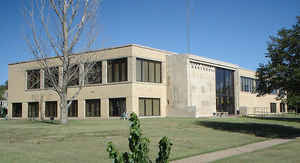
Clark County is a county located in the state of Kansas. Based on the 2010 census, the county population was 2,215. Clark County was created on February 26, 1867. The county seat and most populous city is Ashland. Clark County. The county is named in honor of Charles F. Clarke, Captain in 6th Regiment Kansas Volunteer Cavalry during American Civil War.
Etymology - Origin of Clark County Name
The county was originally and correctly Clarke, with a final e, in memory of Charles F. Clarke, Captain and Adjutant-General, United States Volunteers, who died at Memphis, December 10, 1862.
Demographics:
County QuickFacts: CensusBureau Quick Facts
Clark County History
Clark County.- On Feb. 26, 1867, Gov. Crawford approved an act of the legislature defining the boundaries of a number of new counties in the western part of the state. Section 39 of that act reads: "The county of Clarke shall he bounded as follows: Commencing where the east line of range 21 west
intersects the sixth standard parallel, thence south to the thirty-seventh degree of north latitude, thence west to the east line of range 26 west, thence north to the sixth standard parallel, thence, east to the place of beginning."
By the act of March 6, 1875, the northern boundary was moved northward 6 miles, to the north line of township 30 south, and the western boundary was fixed at the "east line of range 27 west." The county was named for Charles F. Clarke, who entered the volunteer service in the Civil war as a captain
in the Sixth Kansas cavalry, was commissioned assistant adjutant-general on June 12, 1862, and died at Memphis, Tenn., on the 10th of the following December. In the original creative act the name is spelled with the final "e," but in the act of 1873 and all subsequent legislation affecting the
county the last letter was dropped from the name.
As an unorganized county, Clark was attached to Ford county for judicial purposes only until Feb. 21, 1883, when Gov. Glick approved an act including Clark in Ford county, in order that the latter might benefit by the taxation of the large cattle interests. This did not please the few settlers in
Clark county, and by the act of March 7, 1885, Clark was reëstablished with its present boundaries, extending from the east line of range 21 to the east line of range 26 west, and from the north line of township 30 south to the southern boundary of the state. By the same act the county was attached
to Comanche for judicial purposes.
Near the center of the county is an elevation, to which H. C. Inman, quartermaster of the Custer expedition in 1868 gave the name of "Mount Jesus." In the winter of 1868-69 a trail was made from Fort Dodge to Camp Supply in the Indian Territory, over which government supplies were taken to the latter post. It passed near the elevation mentioned, and it became known as the "Mount Jesus trail." In 1870 a new trail was opened, over which the cattle drovers passed to Dodge City and the northern ranges. It was known as the "Texas Cattle Drive," and during the ten years from 1876 to 1885 some 2,000,000 cattle passed over this trail.
Geography: Land and Water
As reported by the Census Bureau, the county has a total area of 977 square miles (2,530 km2), of which 975 square miles (2,530 km2) is land and 2.6 square miles (6.7 km2) (%) is water
Clark county is located in southwest Kansas. The county has an altitude of nearly 2,000 feet. Clark county is mostly a level prairie, sloping gently southward toward the Cimarron river. All the streams of the county are directly or indirectly tributaries to the Cimarron. The main creeks are Bluff, Beaver, Bear, and Big and Little Sand creeks. There is not much native timber in the county, but the most common is the cottonwood and some hackberry, walnut and mulberry.
Neighboring Counties
Bordering counties are as follows:
- North: Ford County
- Northeast: Kiowa County
- East: Comanche County
- Southeast: Harper County, Okla.
- Southwest: Beaver County, Okla.
- West: Meade County
Education
Unified School Districts
Minneola USD 219
Ashland USD 220


Click Image to Enlarge
