


Click Image to Enlarge
Kansas Counties
Kansas has one hundred and five counties. Originally 33 counties were organized by the Territorial Legislature in 1855. The Chase County Courthouse in Cottonwood Falls, Kansas was built in 1873 and is the oldest operating courthouse in Kansas. As of January 1, 2009 Greeley County and the city of Tribune unified to form the Unified Government of Greeley County..Comanche County, Kansas
Comanche County Education, Geography, and History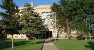
Comanche County is a county located in the state of Kansas. Based on the 2010 census, the county population was 1,891. Comanche County was created on February 26, 1867. The county seat and most populous city is Coldwater. The county is named after the Comanche Native Americans.
Etymology - Origin of Comanche County Name
The county is named in honor of Comanche Native Americans, who lived in the area.
Demographics:
County QuickFacts: CensusBureau Quick Facts
Comanche County History
Comanche County, one of the southern tier, is the sixth county east of the Colorado state line. It was created by an act of the state legislature in 1867, which provided for the division into counties of all the unorganized part of the state east of range line 26 west, and was named for the
Comanche tribe of Indians. The act provided the following bounds for Comanche county: "Commencing where the east line of range 16 west, intersects the 6th standard parallel, thence south to the 37th degree north latitude, thence west to the east line of range 21, thence north to the 6th standard
parallel, thence east to the place of beginning." By political divisions, it is bounded on the north by Kiowa county; east by Barber south by the State of Oklahoma, and west by Clark county. Its area is 795 square miles.
Before the county could be organized it was required by an act of June 4, 1861, that a census be taken and that the county should show a population of "600 inhabitants, excluding Indians not taxed, and who are bona fide residents of the county and the United States."
The county was first organized in 1873, under a general law then in force, and was represented in the Legislature under that organization in 1874, but that organization was held fraudulent and void.
Geography: Land and Water
As reported by the Census Bureau, the county has a total area of 790 square miles (2,000 km2), of which 788 square miles (2,040 km2) is land and 1.4 square miles (3.6 km2) (0.2%) is water.
Comanche county is located in southwest Kansas. The county is level except where the land breaks into bluffs along some of the larger streams. The valleys and second bottom lands are sedimentary deposits and very rich. The main types of timber are mainly cedar, walnut, elm and cottonwood. Sandstone, mineral paint and gypsum are abundant. There are many salt springs located in the southwestern portion. The Cimarron river flows southeast across the southwest corner of the county. Its principal stream in the county are Calvary creek, which flows south through the western part.
Neighboring Counties
Bordering counties are as follows:
- North: Kiowa County
- East: Barber County
- Southeast: Woods County, Okla.
- Southwest: Harper County, Okla.
- West: Clark County
Education
Unified School Districts
Comanche County USD 300


Click Image to Enlarge
