


Click Image to Enlarge
Kansas Counties
Kansas has one hundred and five counties. Originally 33 counties were organized by the Territorial Legislature in 1855. The Chase County Courthouse in Cottonwood Falls, Kansas was built in 1873 and is the oldest operating courthouse in Kansas. As of January 1, 2009 Greeley County and the city of Tribune unified to form the Unified Government of Greeley County..Decatur County, Kansas
Decatur County Education, Geography, and History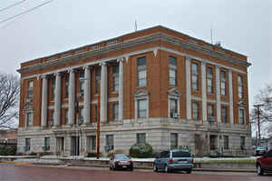
Decatur County is a county located in Northwest Kansas. Based on the 2010 census, the county population was 2,961. Decatur County was created on March 6, 1873. The county seat and most populous city is Oberlin. The county is named in honor of Commodore Stephen Decatur, Jr.
Etymology - Origin of Decatur County Name
The county is named in honor of Commodore Stephen Decatur, a distinguished American naval officer. He fell in a duel with Commodore Barron, United States Navy, in 1808.
Demographics:
County QuickFacts: CensusBureau Quick Facts
Decatur County History
Decatur County.- About 1870 there was a great tide of immigration to the western part of Kansas, which at that time was unorganized and a large portion of it unsurveyed territory. Within two years the population in that section had increased to such an extent as to justify the establishment of a
number of new counties. Accordingly, the legislature of 1873 passed an act creating 22 new counties and providing for their organization. Section 1 of that act reads "The county of Decatur is bounded as follows: Commencing where the east line of range 26 west, intersects the fortieth degree of north
latitude; thence south, with the range line, to the first standard parallel; thence west with said parallel to the east line of range 31 west; thence north with said range line to the fortieth degree of north latitude; thence east with said parallel to the place of beginning."
Decatur county is therefore in the northern tier, and is the third county east of the State of Colorado. It was named for Commodore Stephen Decatur; is exactly 30 miles square, with an area of 900 square miles; is bounded on the north by the State of Nebraska, on the east by Norton county, on the
south by the county of Graham, and on the west by the county of Rawlins.
Geography: Land and Water
As reported by the Census Bureau, the county has a total area of 894 square miles (2,320 km2), of which 894 square miles (2,320 km2) is land and 0.6 square miles (1.6 km2) (0.07%) is water.
The
county is generally rolling prairie, breaking into bluffs along the streams. The northern part is watered by Beaver creek; the central by Sappa creek, and the southern by Prairie Dog creek and the north fork of the Solomon river, all of which flow in a northeasterly direction.
The timber in the area is ash, white elm, box-elder, hackberry and cottonwood. Fine limestone is found in the bluffs along the creeks. Clay
fit for the manufacture of brick and tile is plentiful.
Neighboring Counties
Bordering counties are as follows:
- North: Red Willow County, Neb.
- Northeast: Furnas County, Neb.
- East: Norton County
- South: Sheridan County
- Southwest: Thomas County
- West: Rawlins County
Education
Unified School Districts
Oberlin USD 294
Prairie Heights USD 295, dissolved as of July 1, 2006; absorbed by USD 294.


Click Image to Enlarge
