


Click Image to Enlarge
Kansas Counties
Kansas has one hundred and five counties. Originally 33 counties were organized by the Territorial Legislature in 1855. The Chase County Courthouse in Cottonwood Falls, Kansas was built in 1873 and is the oldest operating courthouse in Kansas. As of January 1, 2009 Greeley County and the city of Tribune unified to form the Unified Government of Greeley County..Doniphan County, Kansas
Doniphan County Education, Geography, and History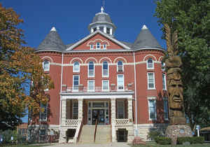
Doniphan County is a county located in the state of Kansas. Based on the 2010 census, the county
population was 7,945.
Doniphan County was created on August 30, 1855. The
county seat is Troy, and its most populous city is Wathena.
The county is named in honor of Colonel Alexander
William Doniphan (1808-1887), of Missouri, who commanded a regiment of
cavalry during the Mexican War and pro-slavery sympathizer in "Bleeding
Kansas".
Doniphan County is included in the St. Joseph, MO-KS Metropolitan Statistical Area, which is also included in the Kansas City-Overland
Park-Kansas City, MO-KS Combined Statistical Area.
Etymology - Origin of Doniphan County Name
The county is named in honor of Col. A. W. Doniphan, of Missouri. He commanded a regiment of cavalry during the Mexican War, marching across the plains, and taking a very prominent part in the conquest of New Mexico. He was a zealous partisan in the effort made to extend slavery into Kansas.
Demographics:
County QuickFacts: CensusBureau Quick Facts
Doniphan County History
Doniphan County, one of the 33 original counties formed by the first territorial legislature and one of the first counties to be organized, is located in the extreme northeastern part of the state. It is small in area, but important historically. The Missouri river forms its northern, eastern and a part of its southern boundary making 90 miles of river front, Atchison county on the south and Brown on the west form its complete boundaries. The white man's era in Doniphan county began with Bourgmont' the French explorer and ambassador to the Indians.
The geological formations of Doniphan county are very interesting. Many relics of prehistoric ages have been taken from the bluffs and banks of streams. A few years ago a large tooth weighing 5 pounds was unearthed. Mounds in which the prehistoric races were accustomed to bury their dead existed in considerable numbers in the early days of the white man's occupation.
Geography: Land and Water
Doniphan County is located in the northeastern corner of the state. The county is bordered by Nebraska to the north and Missouri to the east. As reported by the Census Bureau, the county has a total area of 398 square miles (1,030 km2), of which 393 square miles (1,020 km2) is land and 4.9 square miles (13 km2) (1.2%) is water. It is the third-smallest county in Kansas by land area and second-smallest by total area
The northeastern most county in
Kansas, Doniphan county offers rugged landscapes, spectacular views, and a rich
history. It's apple country with thousands of acres of orchards. The county is rolling except for the bluffs along the Missouri river. There are a number of smaller streams among which Wolf river is the most important. It enters from the west flows in a northeasterly direction through Leona and Severance and empties into the Missouri. Clear
creek and Mission creek also empty into the Missouri.
Limestone is found in considerable quantities, also sandstone of a good quality and potter's clay. Coal is found to some
degree but not in commercial quantities.
Neighboring Counties
Bordering counties are as follows:
- North: Holt County, Mo.
- Northeast: Andrew County, Mo.
- Southeast: Buchanan County, Mo.
- Southwest: Atchison County
- West: Brown County
- Northwest: Richardson County, Neb.
Education
Unified School Districts
Doniphan West USD 111
Riverside USD 114
Troy USD 429
Colleges and universities
Highland Community College was the first college established in the state when the Highland University charter was granted by the Territorial Legislature in 1858. Over time the college lost its affiliation with the Presbyterian Church and changed its name several times before becoming a regional rural community college.


Click Image to Enlarge
