


Click Image to Enlarge
Kansas Counties
Kansas has one hundred and five counties. Originally 33 counties were organized by the Territorial Legislature in 1855. The Chase County Courthouse in Cottonwood Falls, Kansas was built in 1873 and is the oldest operating courthouse in Kansas. As of January 1, 2009 Greeley County and the city of Tribune unified to form the Unified Government of Greeley County..Harvey County, Kansas
Harvey County Education, Geography, and History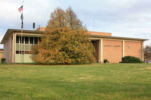
Harvey County is a county located in the state of Kansas. Based on the 2010 census, the county
population was 34,684. Harvey County was
created on March 7, 1872. The county seat and most populous city is Newton.
The county is named in honor of James M. Harvey
(1833-1894), fifth governor of Kansas.
Harvey County is part of the Wichita, KS Metropolitan Statistical Area.
Etymology - Origin of Harvey County Name
The county is named for James M. Harvey, Captain of Company G, Tenth Regiment of Kansas Infantry, and Governor of the State from 1869 to 1873. In January, 1874, he was elected United States Senator to fill the unexpired term ending in 1877.
Demographics:
County QuickFacts: CensusBureau Quick Facts
Harvey County History
Harvey County, named for James M. Harvey, who was governor of Kansas at the time it was organized, is located in the western part of the eastern half of the state, the third county from the Oklahoma line and the sixth from the State of Missouri. It is bounded on the north by McPherson and Marion counties; on the east by Marion and Butler; on the south by Sedgwick, and on the west by Reno, and is crossed a little east of the center by the 6th principal meridian.
The county's history includes the violence of cowtown wickedness, dynamic railroad activity, and prosperous settlements of "Turkey Red" wheat farmers - many of them Mennonite immigrants from Europe. The beautiful Santa Fe depot in Newton is now mostly an office building; one of the tenant's web site has some neat pictures of the station.
Geography: Land and Water
As reported by the Census Bureau, the county has a total area of 541 square miles (1,400 km2), of which 540 square miles (1,400 km2) is land and 1.0 square mile (2.6 km2) (0.2%) is water.
Harvey county is located close to the center of Kansas. The Little Arkansas River flows through the county. The county is prairie, with sand hills in the
farthest northwest, and to some extent rolling in the southeast. The
county has many streams, its water system consisting of the Little Arkansas river and its numerous branches. The Little Arkansas enters in the northwest
corner and flows east a few miles where it is joined by Crooked creek and other streams. From this point it flows southeast. The bottom lands along the streams comprise 30 per cent of the area, which makes this a
excellent farming district. Timber in this county consist of walnut,
cottonwood, elm, hackberry, ash, elm, box-elder, mulberry and sycamore.
Neighboring Counties
Bordering counties are as follows:
- Marion County (northeast)
- Butler County (east)
- Sedgwick County (south)
- Reno County (west)
- McPherson County (northwest)
Education
Unified School Districts
USD 369, Burrton- Burrton, Rural Areas
USD 373, Newton - Newton, Walton, Rural Areas
USD 439, Sedgwick - Sedgwick, Rural Areas
USD 440, Halstead - Halstead, Rural Areas
USD 460, Hesston - Hesston, Rural Areas
District Office In Neighboring County
USD 206, Remington-Whitewater - Rural Areas
USD 398, Peabody-Burns - Rural Areas
USD 411, Goessel - Rural Areas
USD 423, Moundridge - Rural Areas
Colleges
Bethel College, in North Newton
Hesston College, in Hesston


Click Image to Enlarge
