


Click Image to Enlarge
Kansas Counties
Kansas has one hundred and five counties. Originally 33 counties were organized by the Territorial Legislature in 1855. The Chase County Courthouse in Cottonwood Falls, Kansas was built in 1873 and is the oldest operating courthouse in Kansas. As of January 1, 2009 Greeley County and the city of Tribune unified to form the Unified Government of Greeley County..Haskell County, Kansas
Haskell County Education, Geography, and History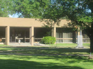
Haskell County is a county located in the state of Kansas. Based on the 2010 census, the county population was 4,256. Haskell County was created on March 23, 1887. The county seat and most populous city is Sublette. The county is named in honor of Dudley Chase Haskell (1842-1883), United States congressman from Kansas.
Etymology - Origin of Haskell County Name
The county is named in honor of Dudley C. Haskell, of Lawrence, who died while serving the State as Congressman, December 16, 1883.
Demographics:
County QuickFacts: CensusBureau Quick Facts
Haskell County History
Haskell County, located in the southwestern part of the state, lies about 30 miles north of Oklahoma and 53 miles east of Colorado. It was created by the act of March 5, 1887, which defined the boundaries as follows: "Commencing at the intersection of the east line of range 31 west with the north
line of township 27 south; thence south along range line to where it intersects the 6th standard parallel; thence west along the 6th standard parallel to its intersection with the east line of range 35 west; thence north along range line to where it intersects the north line of township 27 south;
thence east to the place of beginning."
The boundaries as thus established are the same as those given to Arapahoe county in 1873. It is bounded on the north by Finney county; on the east by Gray and Meade; on the south by Seward, and on the west by Grant. It is exactly 24 miles square and has an area of 576 square miles, or 368,640
acres, and was named for Dudley C. Haskell, formerly a Congressman from Kansas.
The route of the Santa Fe trail cuts
across the northern part of Haskell County, intersecting US 83 about five miles
north of US 160.
The first county seat of Haskell county was Santa Fe, which won over Ivanhoe
when the county was being organized. It was named for Dudley C. Haskell, a U. S.
Congressman from Kansas. Lack of any railroads hampered the growth of the
county. Freight and produce had to be hauled by wagon to Garden City, the
nearest point on a railroad. Finally, in 1912 the AT&SF built a line from Dodge
City to Elkhart. The new line missed the town of Santa Fe by seven miles.
Sublette and Satanta were soon thriving along the new line and an election was
held in 1913 to select a new county seat. This was the first county election in
which all Kansas women were eligible to vote. The county seat was moved to
Sublette in 1920 after another hotly contested election. See Ghost Towns of
Kansas, page 292, for more about the town of Santa Fe.
Geography: Land and Water
As reported by the Census Bureau, the county has a total area of 578 square miles (1,500 km2), of which 578 square miles (1,500 km2) is land and
0.4 square miles (1.0 km2) (0.06%) is water.
Haskell county is located in southwest Kansas. The county is mostly level or gently rolling prairie.
Haskell County is the flattest county in Kansas. The only waterway in the county is the Cimarron river, which flows across the
farthest southwest corner. Timber is scarce and a few artificial groves have been
planted. There are a few natural springs in the county, and good well water is obtained at a depth of from 50 to 100 feet.
Haskell County is the flattest county in Kansas.
Description
Haskell County is "High Plains" country; it's one of Kansas' flattest with grain crops alternating with feedlots and pastureland. One of the best illustrations of the climate is the absolutely treeless golf course west of Satanta. The valley of the (usually dry) Cimarron River cuts across the extreme southwest corner of the county.
The US 56 and tracks of the Cimarron Valley railroad (once part of the Santa Fe) run side-by-side across the county serving the larger towns. US 83 runs arrow straight North and South. US 160 connects highway 56 with Ulysses.
Neighboring Counties
Bordering counties are as follows:
- Finney County (north)
- Gray County (east)
- Meade County (southeast)
- Seward County (south)
- Stevens County (southwest)
- Grant County (west)
- Kearny County (northwest)
Education
Unified School Districts
Sublette USD 374
Satanta USD 507


Click Image to Enlarge
