


Click Image to Enlarge
Kansas Counties
Kansas has one hundred and five counties. Originally 33 counties were organized by the Territorial Legislature in 1855. The Chase County Courthouse in Cottonwood Falls, Kansas was built in 1873 and is the oldest operating courthouse in Kansas. As of January 1, 2009 Greeley County and the city of Tribune unified to form the Unified Government of Greeley County..Hodgeman County, Kansas
Hodgeman County Education, Geography, and History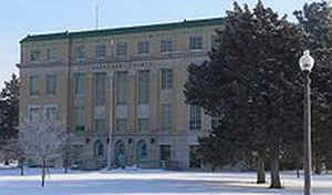
Hodgeman County is a county located in the state of Kansas. Based on the 2010 census, the county population was 1,916. Hodgeman County was created on February 26, 1867. The county seat and most populous city is Jetmore. The county is named in honor of Captain Amos Hodgman of Company H, Seventh Kansas Cavalry.
Etymology - Origin of Hodgeman County Name
The county is named in honor of Amos Hodgman, Captain of Company H, Seventh Kansas Cavalry. He died on October 16, 1863, near Oxford, Mississippi, of wounds received in an action at Wyatt, Mississippi, October 10,1863. The name should be spelled Hodgman without the e--it was so spelled in the original statute of 1868 which created the county, but by accident--probably--in the statute which defined its boundaries in 1873, the e was inserted. Of course it is legally Hodgeman, and must remain orthographically incorrect until changed by legislative enactment.
Demographics:
County QuickFacts: CensusBureau Quick Facts
Hodgeman County History
Hodgeman County.- The territory now included in Hodgeman county was first embraced in Hageman county (q. v.), which was erected by the act of Feb. 26, 1867. By the act of March 6, 1873, Hodgeman county was called into existence with the following boundaries: "Commencing at a point where the 4th
standard parallel intersects the east line of range 21 west; thence south along range line to its intersection with the north line of township 25 south; thence west along township line to where it intersects the east line of range 27 west; thence north along range line to its intersection with the
4th standard parallel; thence east along the line of the 4th standard parallel to the place of beginning."
The county was named for Amos Hodgman, captain of Company H, Seventh Kansas cavalry, who was wounded at Wyatt, Miss., Oct. 10, 1863, and died on the 16th. The original act gave the name as "Hodgman," but a subsequent legislature placed the letter "e" at the end of the first syllable, and that form
has remained. In 1883 the county was enlarged, but in 1887 the original boundaries as established in 1873 were restored. Hodgeman county is bounded on the north by Ness county; on the east by Pawnee and Edwards; on the south by Ford, and on the west by Gray and Finney.
Geography: Land and Water
As reported by the Census Bureau, the county has a total area of 860 square miles (2,200 km2), of which 860 square miles (2,200 km2) is land and 0.3 square miles (0.78 km2) (0.04%) is water.
Hodgeman county is located in west Kansas. The county is rolling prairie. Timber in this county consist of ash, oak, cottonwood, box-elder and hackberry, the total area of natural timber being about 5,000 acres. The Pawnee river flows through the northern part; Buckner creek near the southwest corner and flows in a northeast direction through the county. The southeast part is watered by the Saw Log creek. Limestone and a soft sandstone are found in the bluffs along the streams, native lime is abundant, and there is some gypsum near the center of the county.
Neighboring Counties
Bordering counties are as follows:
- Ness County (north)
- Pawnee County (east)
- Edwards County (southeast)
- Ford County (south)
- Gray County (southwest)
- Finney County (west)
Education
Unified School Districts
Hodgeman County USD 227 (Consolidated in 2011)


Click Image to Enlarge
