


Click Image to Enlarge
Kansas Counties
Kansas has one hundred and five counties. Originally 33 counties were organized by the Territorial Legislature in 1855. The Chase County Courthouse in Cottonwood Falls, Kansas was built in 1873 and is the oldest operating courthouse in Kansas. As of January 1, 2009 Greeley County and the city of Tribune unified to form the Unified Government of Greeley County..Reno County, Kansas
Reno County Education, Geography, and History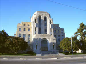
Reno County is a county located in the state of Kansas. Based on the 2010 census, the
population was 64,511. Reno County was created
on February 26, 1867. The county seat is Hutchinson.
The county is named in honor of General Jesse L. Reno.
The Hutchinson, KS Micropolitan Statistical Area includes all of Reno County.
Etymology - Origin of Reno County Name
The county is named in honor of Jesse L. Reno, Captain United States army, and Major-General of Volunteers, who was killed in battle Sept. 14, 1862, at South Mountain, Maryland.
Demographics:
County QuickFacts: CensusBureau Quick Facts
Reno County History
Reno County, in the central part of the state, is bounded on the north by Rice and McPherson counties; on the east by Harvey and Sedgwick; on the south by Sedgwick and Kingman, and on the west by Pratt and Stafford. Its boundary lines were fixed by the legislature of 1868, and it was named in
honor of Gen. Reno, who was killed at the battle of Gettysburg. It was not settled until three years later. The first settlers were not at that time within the confines of Reno county, as the lines have been changed, but all those which shall be mentioned were settlers in Reno county as it now
exists. The last change was made in 1872 when range 4 on the east and a tier of townships from Rice county on the north were added, while a large tract on the south was detached and given to the new county of Kingman.
The huge courthouse was completed in
1931 and was designed by architect William Earl Hulse.
Hutchinson was the western end of the Arkansas Valley Interurban which connected
Wichita, Newton, Halstead, Burrton, and Hutchinson.
One of the rail lines that served Hutchinson was the Hutchinson & Southern, a remarkable railroad built by a group of Kansas businessmen without spending any of their own money. It later became part of the A.T.&S.F.
The industry has been developed on a large scale and the source is seemingly inexhaustible. One of the largest salt plants in the world is in operation in this county.
Geography: Land and Water
As reported by the Census Bureau, the county has a total area of 1,272 square miles (3,290 km2), of which 1,255 square miles (3,250 km2) is land and 17 square miles (44 km2) (1.3%) is water. It is the third-largest county by area in Kansas.
Reno county is located close to the center of Kansas. The county is rolling prairie, in some places nearly level. The county is the third-largest county by area in Kansas.There is ample drainage, the water system including the Arkansas river, the Little Arkansas, the north fork of the Ninnescah, Cow creek and their tributaries. The bottom land makes up 15 per cent of the total area. Timber consist of cottonwood and box-elder. Limestone is found in the northeast and southwest; red sandstone in the northeast and on the forks of the Ninnescah river. Mineral paint is also found along this stream. The salt which places Kansas third in the production of this commodity, is taken from the great beds underlying Reno county.
Neighboring Counties
Bordering counties are as follows:
- Rice County (north)
- McPherson County (northeast)
- Harvey County (east)
- Sedgwick County (southeast)
- Kingman County (south)
- Pratt County (southwest)
- Stafford County (west)
Education
Unified School Districts
USD 308 Hutchinson
USD 309 Nickerson - South Hutchinson
USD 310 Fairfield
USD 311 Pretty Prairie
USD 312 Haven
USD 313 Buhler
USD 369 Burrton


Click Image to Enlarge
