


Click Image to Enlarge
Kansas Counties
Kansas has one hundred and five counties. Originally 33 counties were organized by the Territorial Legislature in 1855. The Chase County Courthouse in Cottonwood Falls, Kansas was built in 1873 and is the oldest operating courthouse in Kansas. As of January 1, 2009 Greeley County and the city of Tribune unified to form the Unified Government of Greeley County..Saline County, Kansas
Saline County Education, Geography, and History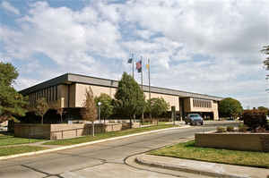
Saline County is a county located in the state of Kansas. Based on the 2010 census, the county
population was
55,606. Saline County was created on February 15,
1860. The county seat is Salina. The
county is named for the Saline River, which flows
through the county.
Saline County is part of the Salina, KS Micropolitan Statistical Area.
Etymology - Origin of Saline County Name
The county is named for the Saline river, whose waters drain a large area of the county.
Demographics:
County QuickFacts: CensusBureau Quick Facts
Saline County History
Saline County, one of the central counties of the state, is the fourth county south from Nebraska, and the eighth from the Missouri river, the 6th principal meridian forming its eastern boundary line. It is bounded on the north by Ottawa county; on the east by Dickinson; on the south by McPherson, and on the west by Ellsworth and Lincoln. The name Saline was given to the river, and later to the county on account of the salt marshes in this section.
At this time all the territory west of the 6th principal meridian was called the "Arapaho district." Saline county was included in this unorganized territory until Feb., 1859, when the legislature passed an act organizing and defining the boundary lines of five counties, of which Saline was one.
Geography: Land and Water
As reported by the Census Bureau, the county has a total area of 721 square miles (1,870 km2), of which 720 square miles (1,900 km2) is land and 1.1 square miles (2.8 km2) (0.2%) is water.Saline county is located close to the center of Kansas. The county is level bottom lands, rolling prairie and highlands, having about an equal area of each. There is a range of high hills near the southern boundary called "Smoky Hill Buttes"; an elevation on the north called "North Pole Mound,"; one 8 miles east of Salina known as "Iron Mound," and in the west is "Soldier Cap." An abundance of limestone, sandstone, gypsum and salt are found in this county. The Solomon river flows across the northeastern part of the county. The Saline enters on the northern boundary and flows southeast and the Smoky Hill enters from the south, flows north to Salina and from there east about 8 miles, where it is joined by the Saline.
Neighboring Counties
Bordering counties are as follows:
- Ottawa County (north)
- Dickinson County (east)
- Marion County (southeast)
- McPherson County (south)
- Ellsworth County (west)
- Lincoln County (northwest)
Education
Public schools
USD 305, Salina - Salina, Rural Areas
USD 306, Southeast Of Saline - Assaria, Bridgeport, Gypsum, Kipp, Mentor, Rural Areas
USD 307, Ell-Saline - Brookville, Bavaria, Hedville, Rural Areas
District Office in neighboring county
USD 240, Twin Valley - Glendale, Rural Areas
USD 393, Solomon - New Cambria, Rural Areas
USD 400, Smoky Valley - Falun, Salemsborg, Smolan, Rural Areas
Private schools
St. John's Military School
Sacred Heart High School
Colleges and universities
Brown Mackie College
Kansas Wesleyan University
Kansas State University Polytechnic Campus
Salina Area Technical College


Click Image to Enlarge
