


Click Image to Enlarge
Kansas Counties
Kansas has one hundred and five counties. Originally 33 counties were organized by the Territorial Legislature in 1855. The Chase County Courthouse in Cottonwood Falls, Kansas was built in 1873 and is the oldest operating courthouse in Kansas. As of January 1, 2009 Greeley County and the city of Tribune unified to form the Unified Government of Greeley County..Scott County, Kansas
Scott County Education, Geography, and History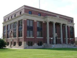
Scott County is a county located in the state of Kansas. Based on the 2010 census, the county population was 4,936. Scott County was created on March 20, 1873. The county seat is Scott City. The county is named in honor of General Winfield Scott.
Etymology - Origin of Scott County Name
The county is named in honor of Major General Winfield Scott, (1786-1866), hero of the War of 1812 and the Black Hawk War, commander of United States forces in the Mexican War, and the first general-in-chief of the Union armies in the Civil War.
Demographics:
County QuickFacts: CensusBureau Quick Facts
Scott County History
Scott County, in the western part of the state, is the third county east from Colorado, the fourth south of Nebraska, and the fourth from the southern boundary of the state. It is bounded on the north by Logan and Gove counties; on the east by Lane; on the south by Finney, and on the west by
Wichita. It was created in 1873 and named for Winfield Scott, a hero in both the War of 1812 and the Mexican war, and commander-in-chief of army at the beginning of the Civil war in 1861. The boundaries were described as follows: "Commencing at the intersection of the east line of range 31 west with
the 3d standard parallel; thence south along range line to its intersection with the 4th standard parallel; thence west along the 4th standard parallel to where it is intersected by the east line of range 35 west; thence north along range line to its intersection with the 3d standard parallel;
thence east to the place of beginning."
The organization of the county was effected in 1886.
The El Quarteljo pueblo in northern
Scott County was settled by Taos & Picurie Indians from New Mexico about 1604.
They abandoned their settlement, which was a meeting place for Spanish and
French travellers, about 1720. Cheyenne Indians from Oklahoma under Dull Knife
fought the "Squaws Den" battle against Army troops under the command of William
H. Lewis near the site of the pueblo in 1874.
Scott County's boundaries were defined when it was surveyed in 1873. The town of
Nixon was founded on the site of modern Scott City about 1879, and homesteaders
began arriving about 1874 to claim up to 480 acres of free or low cost land from
the government. Early towns named Arcola, Painter, and Zenobia were founded but
have vanished. The county was officially organized in 1886 and named for General
Winfield Scott (1786-1866) who was commander of the U. S. troops during our war
with Mexico. County offices were in the building that housed the WCTU (Women's
Christian Temperance Union) Reading Room until a courthouse could be built.
The area had a sort of "boom" when the railroads arrived in 1887. At one time,
Scott City was served by four railroads.
Geography: Land and Water
As reported by the Census Bureau, the county has a total area of 718 square miles (1,860 km2), of which 718 square miles (1,860 km2) is land and 0.1 square miles (0.26 km2) (0.02%) is water.
Scott county is located in west Kansas. The county is rolling prairie with a few sand hills. The main stream is Ladder creek. Ladder creek enters from the west, flows east about 9 miles, then north into Logan county. Ladder creek then drains into the Smoky Hill river. White Woman creek enters in the southwest and flows east and northeast to the center, where it sinks beneath the surface in the middle of a large basin which is filled only in wet seasons. Magnesian limestone is in the north and southwest. Sandstone, gypsum and cement rock also exist in limited quantities.
Neighboring Counties
Bordering counties are as follows:
- Gove County (northeast)
- Lane County (east)
- Finney County (south)
- Kearny County (southwest)
- Wichita County (west)
- Logan County (northwest)
Education
Unified School Districts
Scott County USD 466


Click Image to Enlarge
