


Click Image to Enlarge
Kansas Counties
Kansas has one hundred and five counties. Originally 33 counties were organized by the Territorial Legislature in 1855. The Chase County Courthouse in Cottonwood Falls, Kansas was built in 1873 and is the oldest operating courthouse in Kansas. As of January 1, 2009 Greeley County and the city of Tribune unified to form the Unified Government of Greeley County..Seward County, Kansas
Seward County Education, Geography, and History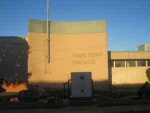
Seward County is a county of the state of Kansas. Based on the 2010 census, the county
population was 22,952. The county was created on March 20, 1873. The
county seat is Liberal. Seward county
is named for William Henry Seward, an American
politician and Secretary of State under Abraham Lincoln and Andrew Johnson.
The Liberal, KS Micropolitan Statistical Area includes all of Seward County.
Etymology - Origin of Seward County Name
The county is named for William H. Seward, Governor and United States Senator of New York, and Secretary of State under Abraham Lincoln.
Demographics:
County QuickFacts: CensusBureau Quick Facts
Seward County History
Seward County, in the southern tier, is the third county east from Colorado. It is bounded on the north by Haskell county; on the east by Meade; on the south by the State of Oklahoma, and on the west by Stevens county. It was created in 1873 and named in honor of William H. Seward of New York,
who was secretary of state during Lincoln's administration. The boundaries were defined as follows: "Commencing at the intersection of the east line of range 31 west with the 6th standard parallel; thence south on said range line to the southern boundary line of the State of Kansas; thence west on
said southern boundary line of the State of Kansas to the east line of range 35 west; thence north on said range line to the 6th standard parallel; thence east to the place of beginning."
Ten years later the area was increased nearly threefold by the addition of territory from the adjoining counties, which for a time lost their identity. In 1886 the original limits were restored and the county was organized.
William Seward was a Senator from New York who fought for Kansas entrance into the Union as a free state. Later as U. S. Secretary of State he negotiated the purchase of "Seward's Folly", Alaska, from Russia.
Geography: Land and Water
As reported by the Census Bureau, the county has a total area of 641 square miles (1,659 km2), of which, 640 square miles (1,656 km2) of it is land and 1 square miles (3 km2) of it (0.15%) is water.
Seward county is located in southwest Kansas. The county is rolling prairie with a few hills. There is almost no timber. The Cimarron river enters near the northwest corner and flows southeast into Meade county. Limestone of good quality is found in the southwest portion.
Neighboring Counties
Bordering counties are as follows:
- Haskell County (north)
- Meade County (east)
- Beaver County, Oklahoma (southeast)
- Texas County, Oklahoma (southwest)
- Stevens County (west)
Education
Unified School Districts
Liberal USD 480
Kismet-Plains USD 483


Click Image to Enlarge
