


Click Image to Enlarge
Kansas Counties
Kansas has one hundred and five counties. Originally 33 counties were organized by the Territorial Legislature in 1855. The Chase County Courthouse in Cottonwood Falls, Kansas was built in 1873 and is the oldest operating courthouse in Kansas. As of January 1, 2009 Greeley County and the city of Tribune unified to form the Unified Government of Greeley County..Sheridan County, Kansas
Sheridan County Education, Geography, and History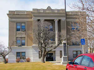
Sheridan County is a county located in the state of Kansas. Based on the 2010 census, the county population was 2,556. Sheridan County was created on March 20, 1873. The county seat is Hoxie. The county is named in honor of Phillip H. Sheridan, a general of the American Civil War era.
Etymology - Origin of Sheridan County Name
The county is named in honor of General Philip Henry Sheridan (1831-1888), active in the post-Civil War Indian campaigns on the plains.
Demographics:
County QuickFacts: CensusBureau Quick Facts
Sheridan County History
Sheridan County, in the northwestern part of the state, is located in the second tier from the north line of the state and is the third county east of Colorado. It is bounded on the north by Decatur; on the east by Graham; on the south by Gove, and on the west by Thomas. It was created in 1873 and named in honor of Gen. Philip H. Sheridan. The boundaries were described as follows: "Commencing where the east line of range 26 intersects the 1st standard parallel; thence south with said range line to the 2d standard parallel; thence west with said standard parallel to the east line of range 31 west; thence north with said range line to the 1st standard parallel; thence east to the place of beginning." The boundaries were redefined in 1879, when the southern line was pushed 6 miles to the north, cutting off a tier of counties, but the original boundaries were restored in 1881.
Sheridan County is named for General Phillip H. Sheridan (1831-1888) of Civil War fame. Sheridan County was created by an act of the Kansas Legislature in 1873. Settlements began here in the 1860's, but it was not until the influx of settlers in 1878 and 1879 that events led to official organization. The town of Kenneth, begun in 1879 north of Hoxie, was the county seat until 1886.
Geography: Land and Water
As reported by the Census Bureau, the county has a total area of 896 square miles (2,320 km2), of which 896 square miles (2,320 km2) is land and 0.3 square miles (0.78 km2) (0.03%) is water.
Sheridan county is located in northwest Kansas. The county is level except along the streams where it is somewhat broken. Bottom lands, which make up 25 per cent of the total area. The north fork of the Solomon river enters in the west, somewhat north of the center and flows northeast into Norton county. The south fork of the same river enters from the west, about 10 miles north of the southwest corner, and flows east into Graham county. The Saline river flows east across the southern level of townships. Timber consist of cottonwood, ash, hackberry, elm, box-elder and wild cherry. Magnesian limestone is found in the east and south.
Neighboring Counties
Bordering counties are as follows:
- Decatur County (north)
- Norton County (northeast)
- Graham County (east)
- Gove County (south)
- Thomas County (west)
Education
Unified School Districts
Hoxie USD 412


Click Image to Enlarge
