


Click Image to Enlarge
Kansas Counties
Kansas has one hundred and five counties. Originally 33 counties were organized by the Territorial Legislature in 1855. The Chase County Courthouse in Cottonwood Falls, Kansas was built in 1873 and is the oldest operating courthouse in Kansas. As of January 1, 2009 Greeley County and the city of Tribune unified to form the Unified Government of Greeley County..Stevens County, Kansas
Stevens County Education, Geography, and History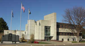
Stevens County is a county located in the state of Kansas. Based on the 2010 census, the county population was 5,724. Stevens County was created on March 20, 1873. The county seat is Hugoton. The county is named for Thaddeus Stevens (1792-1868), a United States senator from Pennsylvania.
Etymology - Origin of Stevens County Name
The county is named for Thaddeus Stevens (1792-1868), a United States senator from Pennsylvania and a passionate advocate of Radical Republicanism.
Demographics:
County QuickFacts: CensusBureau Quick Facts
Stevens County History
Stevens County, one of the southern tier, the second county east of Colorado, is bounded on the north by Grant county; on the east by Seward; on the south by the State of Oklahoma, and on the west by Morton county. It was first created in 1873 and named in honor of Thaddens Stevens of
Pennsylvania. The boundaries were defined as follows: "Commencing at the intersection of the east line of range 35 west with the 6th standard parallel; south along range line to its intersection with the south boundary of the State of Kansas; thence west along said south boundary line of the State
of Kansas to where it is intersected by the east line of range 39 west; thence north along range line to its intersection with the 6th standard parallel; thence east to the place of beginning."
Ten years after it was created the county was obliterated and became a part of Seward. In 1886 the legislature re-established the original boundaries and later in the year it was organized.
Thaddeus Stevens (1792-1868), Congressman from Pennsylvania, was famous for his fierce abolitionist beliefs.
Geography: Land and Water
As reported by the Census Bureau, the county has a total area of 727 square miles (1,880 km2), of which 727 square miles (1,880 km2) is land and 0.2 square miles (0.52 km2) (0.02%) is water.
Stevens
county is located in southwest Kansas. The county is rolling prairie with sand hills. There is no timber. The bottom lands
make up about 2 per cent of the area. The only river of importance is the south fork of the Cimarron, which flows northeast across the
northwest corner. Sandstone is found near the river. Gypsum and clay are
found in other parts of the county.
Neighboring Counties
Bordering counties are as follows:
- Grant County (north)
- Haskell County (northeast)
- Seward County (east)
- Texas County, Oklahoma (south)
- Morton County (west)
- Stanton County (northwest)
Education
Unified School Districts
Moscow USD 209
Hugoton USD 210


Click Image to Enlarge
