


Click Image to Enlarge
Kansas Counties
Kansas has one hundred and five counties. Originally 33 counties were organized by the Territorial Legislature in 1855. The Chase County Courthouse in Cottonwood Falls, Kansas was built in 1873 and is the oldest operating courthouse in Kansas. As of January 1, 2009 Greeley County and the city of Tribune unified to form the Unified Government of Greeley County..Washington County, Kansas
Washington County Education, Geography, and History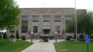
Washington County is a county located in the state of Kansas. Based on the 2010 census, the county population was 5,799. Washington County was created on February 20, 1857. The county seat is Washington. The county is named in honor of George Washington (1732-1799), first president of the United States.
Etymology - Origin of Washington County Name
The county is named in honor of George Washington, the first president of the United States.
Demographics:
County QuickFacts: CensusBureau Quick Facts
Washington County History
The first territorial legislature in 1855, created a county named Washington, with the following described boundaries: "Commencing at the southern boundary of the territory of Kansas, 15 miles west of a due south course from the mouth of Walnut creek, on the Arkansas river, and running from
thence north 100 miles, thence west to the east line of Arapahoe county, thence south along said line to the south line of Kansas, thence east along the said line to the place of beginning."
The southeast corner, as described by this act, was on the southern boundary of the state, about 6 miles west of the present line separating Sumner from Cowley county. The northeast corner was about 3 miles east of the little village of Waldeck in the present county of Marion. As originally created,
this old Washington county included the present counties of Reno, Stafford, Pawnee, Edwards, Hodgeman, Kearny, Hamilton, Stanton, Grant, Haskell, Gray, Ford, Kiowa, Pratt, Kingman, Harper, Barber, Comanche, Clark, Mead, Seward, Stevens and Morton; the southern part of McPherson, Rice, Barton,
Russell Ness, Lane, Scott, Wichita and Greeley; nearly all of Sumner, Sedgwick and Harvey and a little of the southwest part of Marion. Peketon county (q. v.) was created by the legislature of 1860, and embraced all of Washington county as created by the act of 1855.
In 1859 the present county of Washington was created with the following boundaries: "Beginning at the northwest corner of Marshall county, thence west along the base line or northern boundary of the territory to the intersection of the 6th principal meridian; thence south along said principal
meridian to the 1st standard parallel; thence east along said parallel to the southwest corner of Marshall county; thence north with the western boundary of Marshall county to the place of beginning."
The county was named in honor of George Washington. It was not organized at the time of its creation, but was known as Washington township of Marshall county, remaining practically unorganized territory until 1860. As at present organized, the county is bounded on the north by the State of Nebraska;
on the east by Marshall county; on the south by Riley and Clay, and west by Cloud and Republic. It is 30 miles square and has an area of 900 square miles.
Settlers began to come into this area
after the Kansas Territory was opened in 1854. However, most of the thousands of
goldseekers traveled across Washington County in 1849 along the Oregon Trail on
their way to California. Not until 1857 did the first settlers come in numbers
to carve out farms in the rich creek and river valleys. Little did the gold
seekers realize that the lush prairie grass covered a wealth far more precious
and lasting that the glitter of metal.
Swedes, Germans, Dutch, Danes, Bohemians, French, Scots, English, and Irish settled in the county until it became a miniature melting pot all in itself.
The sixth principal meridian was established in the northwest corner of the county on June 11, 1856, and a red sandstone marker was set at this point. From this point all land in Kansas, Nebraska, three quarters of Colorado, most of Wyoming, and a small part of South Dakota was surveyed and numbered. A marker, dedicated on June 11, 1987, or 131 years after being set by Charles Manners, today marks this location.
- Mrs. Billie Jo Smart, Washington
Geography: Land and Water
As reported by the Census Bureau, the county has a total area of 899 square miles (2,330 km2), of which 895 square miles (2,320 km2) is land and 3.9 square miles (10 km2) (0.4%) is water.
Washington county is located in northeast Kansas. The county is rolling, except in the western part and along some of the streams, where it is hilly. Timber consist of elm, cottonwood, ash, walnut, box-elder, maple, honey-locust and bass-wood. The Little Blue river enters the county from the north and flows in a southeast direction into Marshall county. Limestone and sandstone are abundant in all areas of the county. There are several veins of cement stone. Salt springs exist in Mill Creek townships and there are deposits of salt that lie beneath the central and western area and a bed of gypsum 60 feet thick.
Description
Washington, County, Kansas, is an agricultural area thirty miles square with twelve incorporated communities. Crops grown in the county include mainly wheat, milo or grain sorghum, corn, soybeans, alfalfa, prairie hay and some sunflowers. The county ranks high in the state in pork production. Many cow-calf herds roam the beautiful prairie grasslands.
The county is very diversified in industry ranging from metal fabrication
companies, construction, silk screening, woodworking, pet wholesaling, pallet
building, and machining companies.
The geography of the county finds us located in three geologic regions: the
Smoky Hills, Flint Hills, and Glaciated Regions. This gives us a diverse
geography of fertile river and creek valleys, to flatland regions, to rolling
hills, varying across the county.
Neighboring Counties
Bordering counties are as follows:
- Jefferson County, Nebraska (north)
- Gage County, Nebraska (northeast)
- Marshall County (east)
- Riley County (southeast)
- Clay County (south)
- Cloud County (southwest)
- Republic County (west)
- Thayer County, Nebraska (northwest)
Education
The county is served by:
Washington County USD 108
Barnes-Hanover-Linn USD 223
Clifton-Clyde USD 224


Click Image to Enlarge
